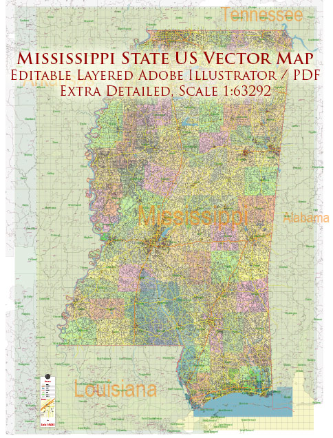
Mississippi is a state located in the southeastern region of the United States. Its principal cities, waterways, and main roads contribute to the state’s geography and connectivity.
Vectormap.Net provide you with the most accurate and up-to-date vector maps in Adobe Illustrator, PDF and other formats, designed for editing and printing. Please read the vector map descriptions carefully.
Principal Cities:
- Jackson:
- As the state capital, Jackson is the largest city in Mississippi. It serves as the political, economic, and cultural center of the state.
- Gulfport:
- Located on the Gulf of Mexico, Gulfport is a major port city with significant maritime and trade activities.
- Hattiesburg:
- Hattiesburg is known for its education and healthcare institutions, including the University of Southern Mississippi and several medical facilities.
- Biloxi:
- Situated on the Mississippi Sound, Biloxi is a coastal city famous for its casinos, seafood, and cultural events.
- Meridian:
- Meridian is an important transportation hub, known for its historic architecture and railroad heritage.
Waterways:
- Mississippi River:
- The western border of Mississippi is defined by the mighty Mississippi River, one of the longest and most significant rivers in North America.
- Gulf of Mexico:
- The southern border of Mississippi is along the Gulf of Mexico, providing access to maritime trade and recreational activities.
- Tennessee-Tombigbee Waterway:
- This artificial waterway connects the Tennessee River to the Tombigbee River, providing a navigable route for barge traffic and enhancing the state’s transportation network.
Main Roads and Highways:
- Interstate 55 (I-55):
- Running north-south, I-55 connects Mississippi to other states, including Tennessee and Louisiana.
- Interstate 20 (I-20):
- Running east-west, I-20 is a major interstate highway that passes through Jackson, providing connectivity across the southern United States.
- U.S. Route 49 (US 49):
- US 49 is a north-south highway connecting Gulfport in the south to Clarksdale in the north, passing through Hattiesburg and Jackson.
- U.S. Route 90 (US 90):
- Running along the Gulf Coast, US 90 provides a scenic route through cities like Biloxi and Gulfport.
- Mississippi Highway 25 (MS 25):
- This north-south state highway runs through central Mississippi, connecting Jackson to cities like Starkville and Tupelo.
These cities, waterways, and highways collectively contribute to the economic, cultural, and transportation aspects of Mississippi, making it a diverse and dynamic state in the southeastern United States.


 Author: Kirill Shrayber, Ph.D.