Illustrator Map Meyrin Switzerland

Illustrator‑Karte — Meyrin Switzerland

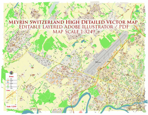
Eine bearbeitbare Illustrator‑Karte von Meyrin Switzerland als verlässliche Basis für Print und Digital. Ufer und Parks erhalten zusätzliche Trennung für besseren Kontrast. Koordinaten und Maßstäbe sind für konsistente Ausgaben vorbereitet. Stadtteil‑Labels sind so gesetzt, dass Kollisionen in dichten Kernen vermieden werden. Typografische Abstände sind für schnelle Lesbarkeit in Postern und Broschüren abgestimmt. Ebenen trennen Haupt‑ und Nebenstraßen, Stadtteile, Hydrographie, Parks und POIs.

Funktioniert als Unterlage für Wayfinding, Verkehrsschemata und Editorial‑Layouts. Eignet sich für Guides, Stadt‑Infografiken, Investorendecks und Kommunikationen. Die Karte fügt sich in DTP‑/GIS‑Workflows ein. Als Basisebene zuverlässig und leicht an neue Projekte anpassbar. Lesbarkeit hält auf Handzetteln wie auf großen Lobby‑Postern. Farbpaletten lassen sich schnell gegen Marken‑Varianten tauschen.

Principal streets and roads in Meyrin, Switzerland, some general information.

Meyrin is a municipality in the canton of Geneva in Switzerland. It is known for hosting the European Organization for Nuclear Research (CERN). The road infrastructure in Meyrin is well-developed, as is typical for Swiss towns. Some of the main roads and streets may include:

  1. Avenue de Feuillasse: This is a significant avenue in Meyrin that may connect different parts of the town.
  2. Route de Meyrin: This road is likely to be one of the main routes in the area, connecting Meyrin to neighboring towns or to major highways.
  3. Avenue de Châtelaine: Another avenue that could be important for navigation within Meyrin.
  4. Rue des Boudines: This street might be one of the residential or commercial streets in Meyrin.
  5. Rue de la Prulay: Yet another street in Meyrin, potentially leading to different neighborhoods or landmarks.

Keep in mind that the exact details may have changed, and for the most accurate and up-to-date information, Vectormap.Net provide you with the most accurate and up-to-date vector maps in Adobe Illustrator, PDF and other formats, designed for editing and printing. Please read the vector map descriptions carefully.

Author: Kirill Shrayber, Ph.D.

I have been working with vector cartography for over 25 years, including GPS, GIS, Adobe Illustrator and other professional cartographic software.
Linkedin: https://www.linkedin.com/in/kirill-shrayber-0b839325/
Twitter: https://twitter.com/vectormapper

Are we missing some maps? Let us know!!!
What map do you need?

    We will upload it within the next 24 hours and notify you by Email.

    Menu