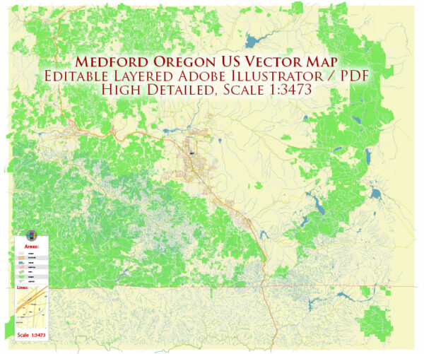
A general overview of the principal waterways, bridges, and main streets in the Medford, Oregon area. Vectormap.Net provide you with the most accurate and up-to-date vector maps in Adobe Illustrator, PDF and other formats, designed for editing and printing. Please read the vector map descriptions carefully.
Principal Waterways:
- Rogue River: The Rogue River flows through the heart of Medford, offering scenic views and recreational opportunities. It is a significant waterway in the region, known for its fishing and rafting.
Bridges:
- I-5 Viaduct: This is a major highway bridge that spans the Rogue River, connecting the northern and southern parts of Medford.
- Barnett Road Bridge: Located in the eastern part of Medford, this bridge crosses over Bear Creek.
Main Streets:
- Main Street: The downtown area of Medford typically features a Main Street with various shops, restaurants, and local businesses.
- Central Avenue: Another key street in Medford, Central Avenue intersects with Main Street and serves as a central corridor for the city.
- Riverside Avenue: This street runs along the Rogue River and offers scenic views. It is also home to various businesses and parks.
- Barnett Road: Barnett Road is a major east-west corridor in Medford, connecting different neighborhoods and commercial areas.
- Stewart Avenue: This street runs parallel to I-5, providing access to various parts of the city.
Keep in mind that the information provided is a general overview, and there may be other important waterways, bridges, and streets in the area. Additionally, developments and changes to infrastructure may have occurred since my last update. For the latest and most accurate information, consider checking with local government sources or maps specific to Medford, Oregon.


 Author: Kirill Shrayber, Ph.D. FRGS