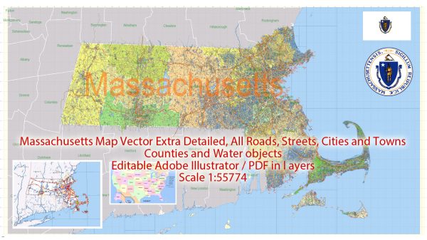
Massachusetts is a state located in the New England region of the northeastern United States. It is known for its rich history, diverse culture, and vibrant cities. Here’s an overview of some of the principal cities, prominent waterways, and main roads in Massachusetts:
Principal Cities:
- Boston:
- The capital and largest city of Massachusetts.
- Known for its historical significance, including the Boston Tea Party and the Battle of Bunker Hill.
- Home to many universities, museums, and cultural institutions.
- Worcester:
- The second-largest city in Massachusetts.
- Known for its healthcare, education, and biotechnology industries.
- Home to Worcester Polytechnic Institute (WPI) and the Worcester Art Museum.
- Springfield:
- Located in western Massachusetts.
- Known for its history, including the Springfield Armory.
- Has a strong cultural scene, including museums and theaters.
- Cambridge:
- Adjacent to Boston and home to Harvard University and the Massachusetts Institute of Technology (MIT).
- Known for its intellectual and cultural influence.
- Lowell:
- Historically known for its textile mills during the Industrial Revolution.
- Features historic sites and a vibrant arts community.
Waterways:
- Charles River:
- Flows through the Boston metropolitan area.
- Popular for recreational activities, such as jogging and boating.
- Merrimack River:
- Flows through cities like Lowell and Lawrence.
- Historically significant for its role in the Industrial Revolution.
- Connecticut River:
- Forms part of the western border of Massachusetts.
- Offers scenic views and outdoor activities.
- Cape Cod Bay:
- Located off the southeastern coast of Massachusetts.
- Known for its picturesque beaches and coastal towns.
Main Roads:
- Interstate 90 (Massachusetts Turnpike):
- Connects Boston to the western part of the state, continuing into New York.
- Interstate 93:
- Runs north-south through the Boston metropolitan area.
- Interstate 95:
- Encircles the Boston metropolitan area and is a major north-south route.
- Route 128 (I-95/I-93 Loop):
- Encircles the greater Boston area and is a major suburban business district.
- Route 2:
- Connects the western part of the state, passing through cities like Worcester.
These are just a few highlights, and there are many more cities, waterways, and roads that contribute to the diversity and character of Massachusetts. The state’s combination of urban centers, historical landmarks, and natural beauty makes it a unique and dynamic part of the United States.
Vectormap.Net provide you with the most accurate and up-to-date vector maps in Adobe Illustrator, PDF and other formats, designed for editing and printing. Please read the vector map descriptions carefully.


 Author: Kirill Shrayber, Ph.D. FRGS