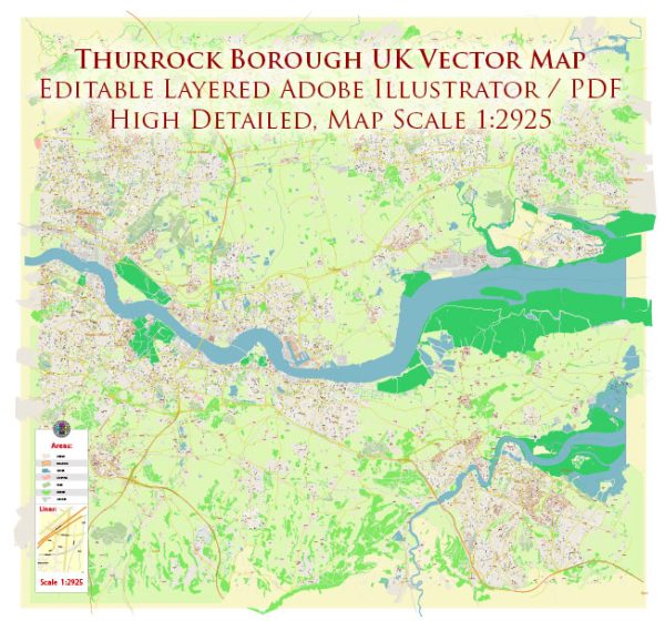
Some general information about Thurrock Borough in the United Kingdom. Vectormap.Net provide you with the most accurate and up-to-date vector maps in Adobe Illustrator, PDF and other formats, designed for editing and printing. Please read the vector map descriptions carefully.
Thurrock is a unitary authority in Essex, England, and it encompasses several towns and communities. Principal waterways, bridges, and main streets in Thurrock may include:
- Waterways:
- River Thames: Thurrock is located along the north bank of the River Thames, and the river plays a significant role in the area’s geography and transportation.
- Bridges:
- Dartford Crossing: While technically located just outside Thurrock, the Dartford Crossing is a major river crossing connecting Thurrock with Dartford in Kent. It consists of two tunnels and the Queen Elizabeth II Bridge, providing a crucial transportation link.
- Main Streets and Roads:
- A13 (Thurrock stretch): The A13 is a major road that passes through Thurrock, connecting London and the Essex coast. It is an important transportation route for both commuters and freight.
- A1089: This road runs through Thurrock, connecting the A13 to the M25 motorway and serving as a key route in the area.
- Orsett Road: Located in Grays, Orsett Road is one of the main streets in the town and hosts various local amenities and businesses.
- London Road (A126): This road connects Grays and Tilbury and is an important route within Thurrock.
- St. Mary’s Lane: Found in Upminster, this road is close to the boundary of Thurrock and is part of the local road network.
- High Street, Aveley: Aveley, one of the towns in Thurrock, has a High Street that serves as a local commercial and residential area.
Remember, Thurrock is a diverse borough with various towns and neighborhoods, each with its own distinctive features. For the most up-to-date and specific information, it’s recommended to consult local maps, official borough websites, or contact the Thurrock Borough Council or relevant local authorities.


 Author: Kirill Shrayber, Ph.D. FRGS