Illustrator Map Map Sumy Ukraine

Illustrator Map — Map Sumy Ukraine

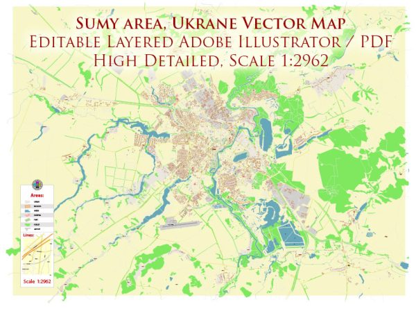
A clean Illustrator map of Map Sumy Ukraine with named layers and consistent geometry for fast cartographic work. Crisp vectors preserve edges at high DPI and export compactly for web delivery. Layer structure separates arterials and locals, districts, hydrography, parks and landmarks. Named layers let you restyle colors, line weights and label classes without cleanup passes. Coordinates and scales are prepared for sheet production and consistent exports. District and neighborhood labels are arranged to avoid collisions around dense cores.

Works well as an underlay for wayfinding, transport schemes and editorial layouts. Use it for visitor guides, city infographics, investment decks and municipal communications. Legibility holds up on handheld leaflets and large lobby posters alike. Editors can brand the palette and icons, then export sharp results for both print and web.

Some general information about Sumy, Ukraine, including its principal waterways, bridges, and main streets. Vectormap.Net provide you with the most accurate and up-to-date vector maps in Adobe Illustrator, PDF and other formats, designed for editing and printing. Please read the vector map descriptions carefully.

Waterways:

  1. Psel River: The Psel River flows through the city of Sumy. It is a tributary of the Dnieper River.

Bridges:

  1. Central Bridge (Tsentralnyi Most): This bridge is a significant landmark in Sumy, connecting different parts of the city over the Psel River.

Main Streets:

  1. Kurskaya Street (Kurska vulitsya): One of the main streets in Sumy, hosting various shops, businesses, and residential areas.
  2. Petropavlivska Street (Petropavlivska vulitsya): Another important street, known for its commercial activities and cultural establishments.
  3. Rymskoho-Korsakova Street: This street is named after the famous Ukrainian composer Mykola Rimsky-Korsakov.
  4. Soborna Street (Soborna vulitsya): Soborna Street often serves as a central thoroughfare and is home to important institutions and businesses.
  5. Haharina Avenue (Haharina prospekt): An avenue that plays a crucial role in the city’s transportation network.
Author: Kirill Shrayber, Ph.D.

I have been working with vector cartography for over 25 years, including GPS, GIS, Adobe Illustrator and other professional cartographic software.
Linkedin: https://www.linkedin.com/in/kirill-shrayber-0b839325/
Twitter: https://twitter.com/vectormapper

Are we missing some maps? Let us know!!!
What map do you need?

    We will upload it within the next 24 hours and notify you by Email.

    Menu