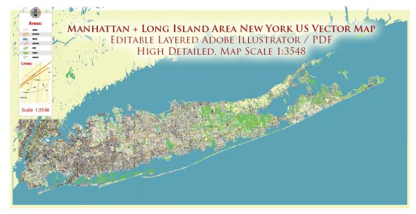
Manhattan and Long Island, located in the state of New York, are connected by various waterways, bridges, and main streets. Here’s an overview of some of the principal features:
Waterways:
- East River: Separates Manhattan from Long Island to the east.
- Harlem River: Connects the Hudson River to the East River, passing through the northern part of Manhattan.
- Hudson River: Flows along the western edge of Manhattan, separating it from New Jersey.
Bridges:
- Brooklyn Bridge: Connects Manhattan to Brooklyn across the East River. Iconic and historic, it offers pedestrian walkways and beautiful views of the skyline.
- Manhattan Bridge: Also spanning the East River, connecting Manhattan to Brooklyn, this bridge is known for its distinctive architecture.
- Williamsburg Bridge: Another bridge across the East River, linking Manhattan to Brooklyn, with pedestrian and bike lanes.
- Queensboro Bridge: Spans the East River, connecting Manhattan to Queens. It’s a vital transportation link and offers great views of the city.
- George Washington Bridge: Located to the north, it connects Manhattan to New Jersey over the Hudson River.
Main Streets and Avenues:
- Broadway: A famous avenue in Manhattan that runs the length of the island, known for its theaters and entertainment venues.
- Fifth Avenue: A major north-south avenue in Manhattan, famous for high-end shopping and cultural institutions.
- Park Avenue: Another prominent avenue in Manhattan, featuring upscale residential and commercial buildings.
- Lexington Avenue: Runs parallel to Park Avenue and is known for its mix of residential and commercial spaces.
- Queens Boulevard: A major thoroughfare in Queens, connecting various neighborhoods and serving as a commercial and residential corridor.
Neighborhoods:
- Financial District: Located in the southern tip of Manhattan, known for Wall Street and the New York Stock Exchange.
- Midtown Manhattan: The central business district, home to iconic landmarks like Times Square and the Empire State Building.
- Greenwich Village: A historic neighborhood known for its bohemian atmosphere, cafes, and Washington Square Park.
- Chelsea: An artsy neighborhood with galleries, the High Line park, and trendy boutiques.
- Brooklyn Heights: A residential neighborhood in Brooklyn known for its historic brownstones and stunning views of Manhattan.
These are just a few highlights, as Manhattan and Long Island are rich in diverse neighborhoods, landmarks, and cultural attractions. The intricate network of waterways and bridges facilitates the movement of people and goods, contributing to the dynamic character of the region.
Vectormap.Net provide you with the most accurate and up-to-date vector maps in Adobe Illustrator, PDF and other formats, designed for editing and printing. Please read the vector map descriptions carefully.


 Author: Kirill Shrayber, Ph.D. FRGS