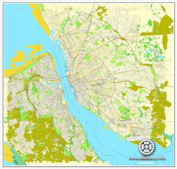
Liverpool and Birkenhead are neighboring cities in the northwest of England, situated along the River Mersey. The two cities are connected by various waterways, bridges, and main streets. Here’s a brief description of some of the principal waterways, bridges, and main streets in Liverpool and Birkenhead:
Waterways:
- River Mersey:
- The River Mersey is a major waterway that flows between Liverpool and Birkenhead. It serves as a natural boundary between the two cities and has played a significant role in their industrial history.
- Liverpool Docks:
- Liverpool has a rich maritime history, and its docks are an essential part of the city. The Albert Dock, in particular, is a UNESCO World Heritage Site and a popular tourist destination with museums, galleries, and shops.
Bridges:
- Mersey Gateway Bridge:
- Connecting Runcorn and Widnes to the south of Liverpool, the Mersey Gateway Bridge is a cable-stayed bridge that opened in 2017. It provides a modern and efficient transportation link across the River Mersey.
- Runcorn Railway Bridge:
- This historic bridge, opened in 1868, is an important railway crossing over the River Mersey, linking Runcorn and Widnes.
Main Streets:
- Liverpool:
- Church Street:
- One of Liverpool’s main shopping streets, Church Street is home to numerous shops, department stores, and cafes.
- Bold Street:
- Known for its independent shops, cafes, and restaurants, Bold Street is a popular destination for those seeking a unique shopping and dining experience.
- Church Street:
- Birkenhead:
- Grange Road:
- Grange Road is a major thoroughfare in Birkenhead, hosting various shops, businesses, and amenities.
- Hamilton Square:
- Surrounded by Georgian terraced houses, Hamilton Square is a significant public space in Birkenhead and is home to the Hamilton Square railway station.
- Grange Road:
These descriptions provide a general overview of the principal waterways, bridges, and main streets in Liverpool and Birkenhead. Both cities have a rich history and offer a mix of historic and modern attractions for residents and visitors alike.


 Author: Kirill Shrayber, Ph.D. FRGS