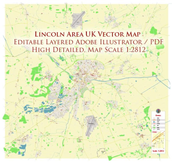
Geographic Description of Lincoln, UK
Lincoln, the county town of Lincolnshire, is situated in the East Midlands region of England. Its geographic significance is highlighted by its position along the River Witham, which flows southeast through the city. Lincoln’s topography is shaped by its location on a ridge of limestone, known as the Lincoln Edge, providing a natural prominence that has historically served defensive and strategic purposes.
- City Layout and Features:
- Uphill and Downhill Lincoln: The city is often divided into two main parts—Uphill Lincoln, where Lincoln Cathedral and Lincoln Castle are located, and Downhill Lincoln, encompassing the modern city center and industrial areas. The aptly named Steep Hill connects these two areas, a narrow and historic cobbled street lined with independent shops and eateries.
- The Brayford Pool: An inland harbor formed by a widening of the River Witham, Brayford Pool is a focal point for leisure and commerce, surrounded by restaurants, hotels, and the University of Lincoln campus.
- Surrounding Geography:
- To the west lies the flat agricultural land of the Trent Valley.
- To the east, the Fens, a low-lying, marshy region, extend toward the North Sea.
- The Lincolnshire Wolds, an Area of Outstanding Natural Beauty, are located to the northeast.
- Lincoln is well-connected by road and rail, with the A15 and A46 major routes converging near the city.
- Climate:
Lincoln experiences a temperate maritime climate with moderate rainfall throughout the year. Summers are mild, while winters are cool with occasional frosts.
Brief History of Lincoln
- Pre-Roman and Roman Era:
- Originally a settlement of the Britons, the site was named Lindon, meaning “pool” or “lake” in reference to Brayford Pool.
- After the Roman invasion in 43 AD, Lincoln became a prominent Roman city named Lindum Colonia. It was an important colonia (retirement settlement for Roman soldiers) and a key point on the Fosse Way, a major Roman road.
- Medieval Period:
- Following the Norman Conquest in 1066, Lincoln grew significantly. William the Conqueror ordered the construction of Lincoln Castle in 1068.
- Lincoln Cathedral, originally built in 1072, became one of the finest examples of Gothic architecture in Europe and held the title of the tallest building in the world for 238 years.
- During the medieval period, Lincoln thrived as a center for wool production and trade, connected to other regions by waterways.
- Industrial Era:
- In the 19th century, Lincoln’s economy shifted toward engineering and manufacturing, particularly agricultural machinery.
- The arrival of railways facilitated industrial growth and urban expansion.
- Modern Period:
- Today, Lincoln is a vibrant mix of historical heritage and modern development, with tourism, education (University of Lincoln), and retail forming the backbone of its economy.
- Its historic sites, such as the Cathedral, Castle (home to one of four surviving copies of the Magna Carta), and Roman relics, draw visitors from around the world.
Lincoln’s juxtaposition of historical significance and contemporary charm makes it a fascinating city both for study and exploration.
Lincoln is a historic city in the East Midlands of England, known for its rich heritage and medieval architecture. The city is situated on the River Witham, and its principal waterways and bridges contribute to its picturesque charm. Here’s a brief description of Lincoln’s main waterways, bridges, and some notable streets:
Waterways:
- River Witham: The River Witham runs through the heart of Lincoln, dividing the city into distinct areas. The river has played a crucial role in the city’s history and is often lined with scenic pathways.
Bridges:
- High Bridge: One of the most iconic landmarks in Lincoln, High Bridge is a medieval bridge that spans the River Witham. It is the oldest bridge in the United Kingdom that still has buildings on it. The bridge is lined with shops and cafes, creating a unique and charming atmosphere.
- Brayford Bridge: This modern bridge crosses the Brayford Pool, a natural lake in the city. The Brayford Pool area is a popular destination for dining, entertainment, and relaxation, with several restaurants and bars along the waterfront.
Main Streets:
- Steep Hill: One of the most famous streets in Lincoln, Steep Hill lives up to its name with a steep incline leading from the city center to the historic uphill area. The street is lined with a mix of independent shops, tearooms, and boutiques, offering a delightful shopping experience.
- High Street: As in many British cities, High Street in Lincoln is a bustling thoroughfare lined with a variety of shops, cafes, and businesses. It connects the lower town to the uphill area and is a central hub for both locals and visitors.
- Silver Street: Parallel to High Street, Silver Street is another notable thoroughfare in Lincoln. It features a mix of shops, pubs, and historic buildings, contributing to the city’s character.
- Waterside: Running along the waterfront of the Brayford Pool, Waterside is a vibrant area with a range of restaurants, bars, and entertainment options. It offers picturesque views of the water and is a popular destination for leisure and socializing.
Lincoln’s layout, with its historic bridges, charming streets, and the scenic River Witham, creates a distinctive atmosphere that combines medieval heritage with modern amenities. Exploring these areas provides a glimpse into the city’s past while enjoying its present-day offerings.


 Author: Kirill Shrayber, Ph.D. FRGS