Illustrator Map Laval Mayenne France

Carte pour Illustrator — Laval Mayenne France

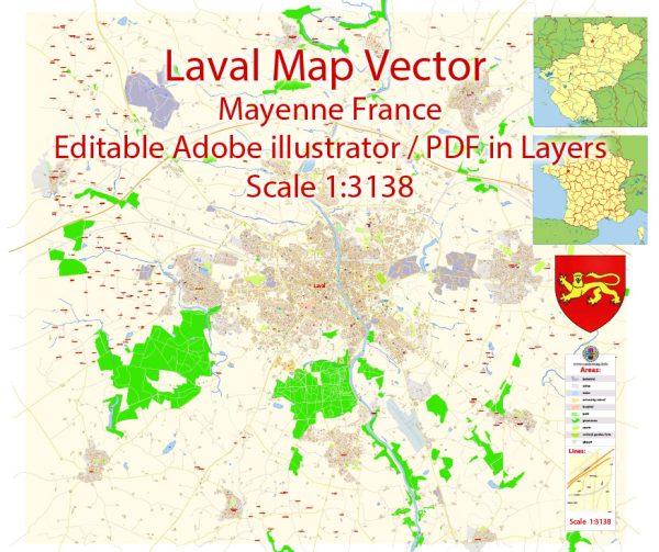
Une carte pour Illustrator propre de Laval Mayenne France, couches nommées et géométrie cohérente pour un travail rapide. Coordonnées et échelles sont prêtes pour des exports constants. Les libellés de quartiers sont disposés pour éviter les collisions dans les centres denses. Ponts et tunnels sont isolés pour garder des itinéraires lisibles après recolorisation. Les couches nommées permettent de recoloriser, régler épaisseurs et classes de libellés. L’espacement typographique est calibré pour une lecture rapide sur affiches et brochures.

Économise de la prépresse en limitant les corrections et en stabilisant la hiérarchie. Idéal pour signalétique, plans d’événements, brochures campus et fronts d’eau. La lisibilité tient sur flyers et grands posters d’accueil. La palette et les icônes de marque s’appliquent facilement; export net pour print/web.

Principal streets and roads in Laval, Mayenne, France, a general information on the city’s road network.

Laval is a commune in the Mayenne department in northwestern France. It is known for its historical architecture and picturesque landscapes. The city has a network of streets and roads that connect its various neighborhoods and landmarks. Some key points of interest in Laval include the Château de Laval, the Old Bridge (Vieux Pont), and the Cathedral of Saint Maurice.

To obtain detailed and up-to-date information about the principal streets and roads in Laval, including their names, locations, and characteristics, I recommend checking with local authorities, such as the municipal government or a local tourism office. You can also use online maps and navigation services to explore the city’s streets and plan your routes.

We provide you with the most accurate and up-to-date vector maps in Adobe Illustrator, PDF and other formats, designed for editing and printing. Please read the vector map descriptions carefully.

Author: Kirill Shrayber, Ph.D.

I have been working with vector cartography for over 25 years, including GPS, GIS, Adobe Illustrator and other professional cartographic software.
Linkedin: https://www.linkedin.com/in/kirill-shrayber-0b839325/
Twitter: https://twitter.com/vectormapper

Are we missing some maps? Let us know!!!
What map do you need?

    We will upload it within the next 24 hours and notify you by Email.

    Menu