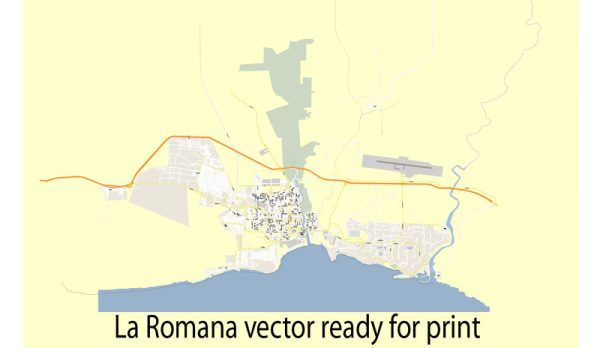
A general overview of the waterways, bridges, and main roads in La Romana, Dominican Republic. Please note that there may have been changes or developments. We provide you with the most accurate and up-to-date vector maps in Adobe Illustrator, PDF and other formats, designed for editing and printing. Please read the vector map descriptions carefully.
Waterways:
La Romana is located on the southeastern coast of the Dominican Republic, and it has a significant port that plays a crucial role in the region’s trade and tourism. The main waterway associated with La Romana is the Chavón River, which flows through the area. The Chavón River is not only important for transportation but also adds to the scenic beauty of the region.
Bridges:
One notable bridge in the La Romana area is the Francisco A. Caamaño Deñó Bridge, commonly known as the Caamaño Bridge. This bridge spans the Chavón River, connecting La Romana with the town of Higüey. It is a key infrastructure element for transportation in the region.
Main Roads:
- Autovía Del Coral (Highway 3): This is a major highway that connects La Romana with other important cities in the Dominican Republic. It is a well-traveled route for both local and long-distance transportation.
- Carretera La Romana-Higüey (Highway 4): This road connects La Romana with Higüey and is an important route for regional travel.
- Avenida Santa Rosa: This is one of the main avenues within La Romana and serves as a key artery for local transportation within the city.
- Boulevard La Romana-Bayahibe: Connecting La Romana with the nearby tourist destination of Bayahíbe, this road is important for both local residents and tourists.
Please be aware that infrastructure and road networks can change, and it’s advisable to check with local sources or recent maps for the most up-to-date information on waterways, bridges, and main roads in La Romana, Dominican Republic.


 Author: Kirill Shrayber, Ph.D.