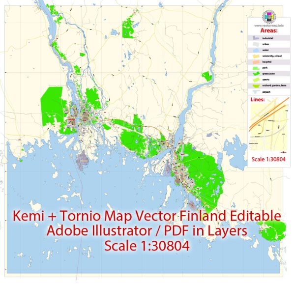
Tornio and Kemi are neighboring towns in northern Finland, and they are often considered as a twin city. Both towns are located on the Gulf of Bothnia, near the border with Sweden. While Tornio is in the region of Lapland, Kemi is in the region of Northern Ostrobothnia. The towns are connected by several roads, and they share some common streets and routes. We provide you with the most accurate and up-to-date vector maps in Adobe Illustrator, PDF and other formats, designed for editing and printing. Please read the vector map descriptions carefully.
Some principal streets and roads in Tornio and Kemi include:
- E8 (European Route E8): This major European route passes through both Tornio and Kemi. It is a significant road that connects the two towns and continues further south.
- Kemintie (Kemi Road): Kemintie is a key road in the region, connecting Kemi to other nearby areas. It is likely to be one of the primary routes within the towns.
- Rantatie (Shore Road): As both Tornio and Kemi are located on the Gulf of Bothnia, there may be a road named Rantatie, which translates to “Shore Road.” This road could offer scenic views along the waterfront.
- Keskuspuisto (Central Park): In both towns, there may be a central park or a central area known as Keskuspuisto.
- Torikatu (Market Street): Many Finnish towns have a street named Torikatu, which often translates to “Market Street.” It could be a central street in the town, potentially hosting markets and events.
- Asemakatu (Station Street): Asemakatu is a common name for streets near train stations. Both Tornio and Kemi have train stations, and Asemakatu may be a relevant street name in these areas.
- Kauppakatu (Market Street): Similar to Torikatu, Kauppakatu translates to “Market Street” and is commonly found in Finnish towns.
It’s important to note that the street names and road configurations may vary, and the information provided is a general overview. For the most accurate and up-to-date information, you may want to consult local maps or official city planning resources for Tornio and Kemi.


 Author: Kirill Shrayber, Ph.D. FRGS