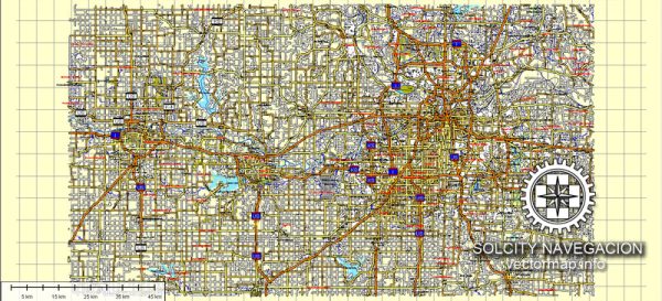
A general description of the principal streets and roads in Kansas City, Lawrence, and Topeka. We provide you with the most accurate and up-to-date vector maps in Adobe Illustrator, PDF and other formats, designed for editing and printing. Please read the vector map descriptions carefully.
Kansas City:
Major Streets:
- Main Street: Running north-south, it is one of the city’s primary thoroughfares, hosting a mix of businesses, entertainment venues, and cultural attractions.
- Grand Boulevard: Another significant north-south artery, connecting various neighborhoods and cultural institutions.
Highways:
- Interstate 70 (I-70): A major east-west interstate passing through Kansas City.
- Interstate 435 (I-435): A beltway around the city, facilitating traffic flow.
Lawrence:
Major Streets:
- Massachusetts Street (Mass Street): The main downtown street, known for its historic buildings, shops, restaurants, and vibrant atmosphere.
- 23rd Street: An important east-west route connecting different parts of Lawrence.
Highways:
- Kansas Highway 10 (K-10): Running east-west, it connects Lawrence to the Kansas City metropolitan area.
Topeka:
Major Streets:
- Kansas Avenue: Topeka’s primary north-south street, featuring government buildings, businesses, and cultural institutions.
- 6th Avenue: An east-west thoroughfare passing through the heart of the city.
Highways:
- Interstate 70 (I-70): Passing through Topeka, it connects the city to other major locations in Kansas and beyond.
General Notes:
- Interstate Highways: Kansas City, Lawrence, and Topeka are well-connected by the interstate highway system, making transportation efficient.
- Local Developments: Each city has its own unique local streets and neighborhoods with distinct characteristics. In Kansas City, the Plaza District and Westport are notable areas. In Lawrence, the University of Kansas campus and historic neighborhoods are key features. In Topeka, the Capitol Building and the historic Potwin neighborhood are noteworthy.
For the most accurate and up-to-date information, it’s recommended to consult local maps, navigation apps, or official city websites. Local traffic authorities or chambers of commerce can also provide detailed information about road networks and any recent changes or developments.


 Author: Kirill Shrayber, Ph.D. FRGS