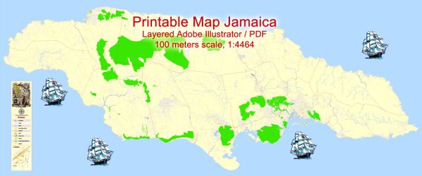
Jamaica is an island country situated in the Caribbean Sea. It is known for its vibrant culture, reggae music, and stunning landscapes. The country is divided into 14 parishes, and each parish has its own capital and major towns. Here are some of the main cities and towns in Jamaica:
- Kingston: The capital and largest city of Jamaica, located on the southeastern coast. Kingston is the cultural and economic center of the country, with a mix of historic and modern landmarks.
- Montego Bay: A major tourist destination on the northwestern coast, Montego Bay is known for its beautiful beaches, resorts, and vibrant nightlife.
- Ocho Rios: Situated on the northern coast, Ocho Rios is a popular cruise ship port and tourist destination. It is known for attractions such as Dunn’s River Falls and Mystic Mountain.
- Negril: Located on the western tip of the island, Negril is famous for its long, sandy beaches and stunning sunsets. It is a laid-back resort town with a relaxed atmosphere.
- Spanish Town: The former capital of Jamaica, Spanish Town is located in the parish of St. Catherine. It has a rich history and is home to several historic buildings.
- Mandeville: Found in the cool hills of central Jamaica, Mandeville is known for its pleasant climate and is a center for agriculture and education.
- Portmore: Situated to the south of Kingston, Portmore is a rapidly growing urban area known for its residential developments and commercial activities.
As for main roads in Jamaica, the road network is extensive, connecting major cities and towns across the island. The primary highway is the A1 or North-South Highway, which runs from Kingston in the south to Ocho Rios, and further to Montego Bay in the north. The A3 highway connects Kingston to Mandeville, while the A2 highway connects Kingston to the eastern part of the island.
Local roads connect the parishes and towns, providing access to various attractions, communities, and scenic spots. Driving in Jamaica allows visitors to experience the diverse landscapes, from coastal areas to mountainous regions. It’s important to note that driving is on the left side of the road in Jamaica.


 Author: Kirill Shrayber, Ph.D. FRGS