Illustrator Map Inari Ivalo Saariselka Finland

Illustrator Map — Inari Ivalo Saariselka Finland

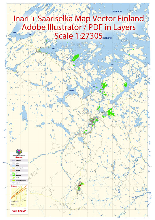
An editable Illustrator map of Inari Ivalo Saariselka Finland designed as a dependable base for print and digital layouts. District and neighborhood labels are arranged to avoid collisions around dense cores. Bridges, tunnels and ferry lines are isolated so routes remain legible after recolor. Typography spacing is tuned for quick reading on posters, brochures and reports. Contours and landuse layers can be toggled to match tourism or planning use cases. Crisp vectors preserve edges at high DPI and export compactly for web delivery.

Works well as an underlay for wayfinding, transport schemes and editorial layouts. Saves prepress time by reducing manual fixes and keeping the visual system consistent. Files remain compact thanks to clean geometry and disciplined labeling. Editors can brand the palette and icons, then export sharp results for both print and web.

Principal streets and roads in Inari, Ivalo, and Saariselkä, Finland. However, I can provide you with some general information on these locations.

  1. Ivalo:
    • Ivalo is a village in the municipality of Inari, located in northern Finland.
    • E75 is a major road passing through Ivalo, connecting it with other towns and cities in Finland.
  2. Saariselkä:
    • Saariselkä is a popular tourist destination, especially for winter activities, situated in the northern part of Finland.
    • The main road leading to Saariselkä is typically the E75, which also passes through Ivalo.
  3. Inari:
    • Inari is a municipality in Finland, and it includes various villages and settlements.
    • Inari is located in the Lapland region, known for its beautiful landscapes and cultural attractions.
    • The E75 road is one of the major routes passing through the municipality.

For the most accurate and up-to-date information on principal streets and roads in these areas, I recommend checking with local sources such as maps, official tourism websites, or contacting the municipal or regional transportation authorities in Finland. We provide you with the most accurate and up-to-date vector maps in Adobe Illustrator, PDF and other formats, designed for editing and printing. Please read the vector map descriptions carefully.

Author: Kirill Shrayber, Ph.D.

I have been working with vector cartography for over 25 years, including GPS, GIS, Adobe Illustrator and other professional cartographic software.
Linkedin: https://www.linkedin.com/in/kirill-shrayber-0b839325/
Twitter: https://twitter.com/vectormapper

Are we missing some maps? Let us know!!!
What map do you need?

    We will upload it within the next 24 hours and notify you by Email.

    Menu