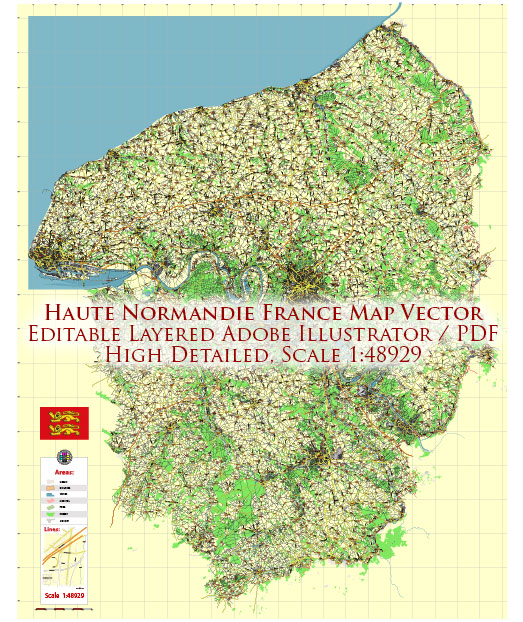
Haute-Normandie was an administrative region in northern France. However, please note that administrative divisions may change, and it’s always a good idea to check for the latest information.
Haute-Normandie, or Upper Normandy, was known for its picturesque landscapes, historic sites, and cultural richness. The region was characterized by a mix of urban and rural areas, with significant agricultural and industrial activities. Some of the principal waterways and main roads in the Haute-Normandie region included:
Principal Waterways:
- Seine River: The Seine River flows through Haute-Normandie, connecting important cities such as Rouen and Le Havre. Rouen, the capital of the region, is situated on the Seine and has been a historically significant port.
Main Roads:
- A13 (Autoroute de Normandie): The A13 is a major autoroute (highway) that connects Paris to Caen, passing through the northern part of Haute-Normandie. It is an important transportation route for both passenger and freight traffic.
- A28 (Autoroute des Estuaires): The A28 is another autoroute that passes through Haute-Normandie, connecting cities like Rouen and Abbeville. It serves as a vital link between the region and other parts of France.
- N roads (National roads): The national road network, including N31, N138, and others, connects various towns and cities within the region and facilitates transportation.
- Local Roads: Numerous local roads crisscross the region, providing access to smaller towns, villages, and rural areas.
Railways: Rail transportation is also significant in Haute-Normandie, with railway lines connecting major cities and industrial centers. Rouen and Le Havre are important railway hubs.
It’s advisable to consult current maps, transportation authorities, or local resources for the most up-to-date information on waterways and roads in the Haute-Normandie region.


 Author: Kirill Shrayber, Ph.D. FRGS