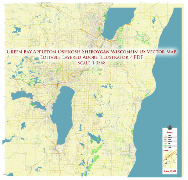
Green Bay and Sheboygan are both located in the state of Wisconsin, USA. Here’s an overview of the principal waterways and main roads in the region:
Green Bay:
Waterways:
- Green Bay: The city is situated at the head of Green Bay, an arm of Lake Michigan. Green Bay itself serves as a significant waterway for shipping and recreational activities.
- Fox River: The Fox River flows through Green Bay, providing a crucial water route. The river is navigable and plays a role in the transportation of goods.
Main Roads:
- Interstate 41 (I-41): This major north-south interstate highway passes through Green Bay, connecting the city with Milwaukee to the south and other points in Wisconsin.
- State Highway 29 (WI-29): Running east-west, WI-29 connects Green Bay to Wausau and other parts of central and western Wisconsin.
- U.S. Route 41 (US-41): This highway traverses the Green Bay area, providing a north-south route and connecting the city with other communities in the region.
Sheboygan:
Waterways:
- Sheboygan River: The Sheboygan River flows through the city and into Lake Michigan. It has played a historic role in the development of Sheboygan.
- Lake Michigan: Sheboygan is located along the shores of Lake Michigan, one of the Great Lakes. The lake provides not only a scenic backdrop but also opportunities for recreation and shipping.
Main Roads:
- Interstate 43 (I-43): Passing near Sheboygan, I-43 is a north-south interstate highway connecting the city with Milwaukee to the south and Green Bay to the north.
- Wisconsin Highway 23 (WI-23): This east-west highway runs through Sheboygan, connecting the city with Fond du Lac to the west and Plymouth to the east.
- Wisconsin Highway 42 (WI-42): Running north-south, WI-42 connects Sheboygan with Manitowoc to the north and eventually continues southward.
These waterways and roads contribute to the transportation and connectivity of Green Bay and Sheboygan, facilitating both local and regional movement of goods and people. The proximity to Lake Michigan also adds a significant maritime aspect to the transportation infrastructure in the region.


 Author: Kirill Shrayber, Ph.D.