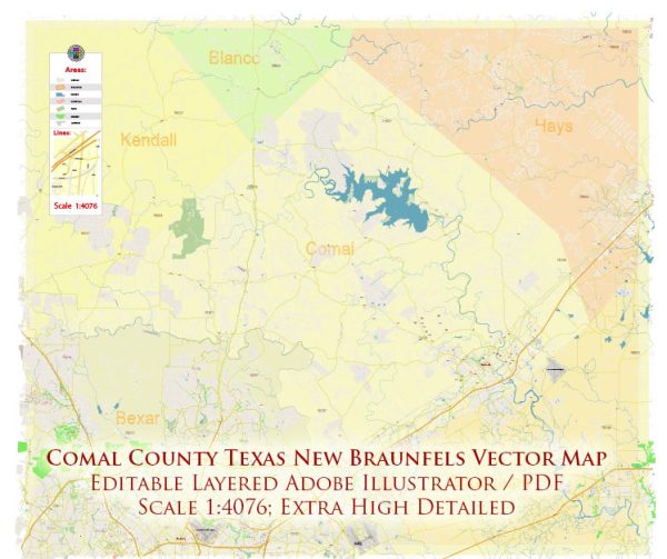
Comal County, Texas, is known for its waterways and road networks. Please note that information might have changed, and it’s advisable to verify with local authorities or official sources for the latest details. Here’s a general overview:
Principal Waterways:
- Guadalupe River: The Guadalupe River flows through the county, offering recreational opportunities such as tubing, kayaking, and fishing. It is a popular destination for outdoor enthusiasts.
- Comal River: Another significant waterway in the area is the Comal River. It is one of the shortest navigable rivers in the world and is known for its crystal-clear waters. Like the Guadalupe River, the Comal River is also popular for tubing and water-based activities.
- Canyon Lake: While not a river, Canyon Lake is a reservoir located in Comal County. It was formed by the damming of the Guadalupe River and provides opportunities for boating, fishing, and other water-related activities.
Main Roads:
- Interstate 35 (I-35): This major interstate highway runs through the eastern part of Comal County, connecting it to cities such as San Antonio to the south and Austin to the north.
- U.S. Highway 281: This north-south highway passes through the western part of Comal County, providing a route to cities like San Antonio.
- State Highway 46 (SH 46): Running east-west, SH 46 crosses through Comal County, connecting New Braunfels to Boerne and Seguin.
- Farm to Market Road 306 (FM 306): This road runs east-west, connecting the cities of New Braunfels and Canyon Lake.
- Farm to Market Road 725 (FM 725): Running north-south, FM 725 provides a route from New Braunfels to McQueeney.
These roads and waterways are vital for transportation, commerce, and tourism in Comal County. For the most current and detailed information, consider checking with local transportation authorities or the Comal County Engineer’s Office. Additionally, the Texas Department of Transportation can provide up-to-date information on road networks in the area.


 Author: Kirill Shrayber, Ph.D.