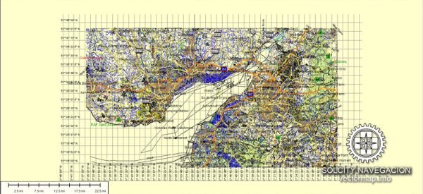
A general overview of some principal streets and roads in Cardiff, Newport, Bristol, and Bath in the United Kingdom.
Cardiff:
- Queen Street: A major shopping street in the city center, known for its shops, restaurants, and entertainment venues.
- St. Mary Street: Another popular street in the city center with a range of shops, bars, and clubs.
- Cardiff Bay Barrage: A scenic route along the Cardiff Bay waterfront, offering views of the bay and the Cardiff Barrage.
- A470: A major road connecting Cardiff to the north of Wales.
Newport:
- High Street: A central street with shops, cafes, and restaurants.
- Newport Bridge Street: Connects the city center to the east bank of the River Usk.
- M4 Motorway: A major motorway passing through Newport, connecting it with Cardiff and Bristol.
Bristol:
- Park Street: A historic street with shops, cafes, and restaurants, connecting the city center to Clifton.
- Bristol Harbourside: A scenic area with waterfront attractions, including museums, galleries, and restaurants.
- M32 Motorway: Connects Bristol to the M4 motorway and provides access to the city center.
- Clifton Suspension Bridge: A famous suspension bridge connecting Clifton in Bristol to Leigh Woods in North Somerset.
Bath:
- Pulteney Bridge: A picturesque bridge with shops spanning the River Avon.
- Milsom Street: A shopping street in the city center with a mix of high-end and independent shops.
- Royal Crescent: A famous crescent-shaped row of Georgian townhouses.
- A36: A major road connecting Bath to Salisbury and Southampton.
For the most accurate and up-to-date information, it’s recommended to check with local authorities or use online mapping services that provide real-time data. Additionally, urban development projects or changes in infrastructure might have occurred after my last update.


 Author: Kirill Shrayber, Ph.D. FRGS