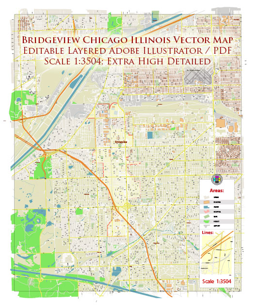
A general overview of the principal streets and roads in Bridgeview, Chicago, Illinois.
Bridgeview is a suburb located southwest of Chicago. Some of the principal streets and roads in and around Bridgeview include:
- Harlem Avenue (IL-43): Harlem Avenue is a major north-south road that runs through Bridgeview. It provides access to various businesses, residential areas, and connects to other significant roads.
- 79th Street: Running east-west, 79th Street is a key thoroughfare in Bridgeview, linking different neighborhoods and facilitating local traffic.
- Archer Avenue: Archer Avenue is another important road in the area. It intersects with Harlem Avenue and serves as a major east-west route.
- 85th Street: This east-west street runs through Bridgeview and plays a role in local transportation.
- La Grange Road (US-45): La Grange Road is a major north-south route that passes near Bridgeview, providing additional connectivity to neighboring areas.
- Toyota Park Lane: Now known as SeatGeek Stadium, Toyota Park Lane surrounds SeatGeek Stadium, a major entertainment and sports venue in Bridgeview. The road provides access to the stadium and nearby parking areas.
- 103rd Street: Running east-west, 103rd Street is another local road that contributes to the overall road network in Bridgeview.
Please keep in mind that this is a general overview, and specific details may have changed. Additionally, road names, conditions, and infrastructure can evolve over time. For the most accurate and up-to-date information, consider checking with local authorities or using online maps and navigation tools.


 Author: Kirill Shrayber, Ph.D. FRGS