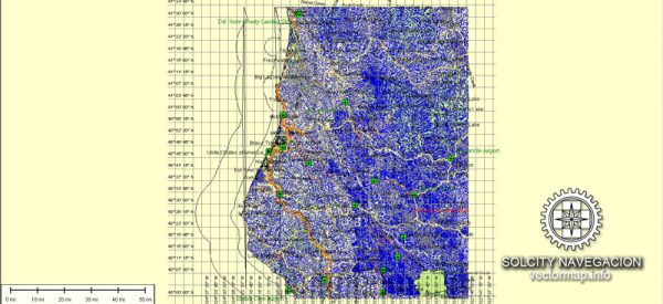
A general overview of the transportation system in Humboldt County, California.
1. Highways:
- U.S. Route 101: This major north-south highway runs through Humboldt County, connecting it to the rest of California.
- State Route 299: This east-west highway provides access to communities in the central and eastern parts of the county.
2. Public Transportation:
- Redwood Transit System: The Redwood Transit System provides bus services connecting various communities in Humboldt County. It is managed by the Humboldt County Association of Governments (HCAOG).
3. Airports:
- Arcata-Eureka Airport (ACV): Located in McKinleyville, this airport serves the region and provides commercial flights.
4. Ports:
- Humboldt Bay: The bay serves as a natural harbor and has a port that facilitates maritime activities.
5. Rail:
- The Northwestern Pacific Railroad historically served the region, but as of my last update, passenger rail services were not widespread.
6. Local Roads:
- Humboldt County has an extensive network of local roads and streets connecting its cities, towns, and rural areas.
7. Cycling and Walking:
- Some areas in Humboldt County may have bike lanes or walking paths to promote alternative modes of transportation.
8. Transportation Planning:
- The Humboldt County Association of Governments (HCAOG) plays a role in coordinating transportation planning and projects in the region.
For the most accurate and up-to-date information, you may want to refer to local government transportation departments, such as the Humboldt County Department of Public Works or the HCAOG. Additionally, checking with local news sources or official transportation websites can provide the latest developments in the transportation system of Humboldt County.


 Author: Kirill Shrayber, Ph.D. FRGS