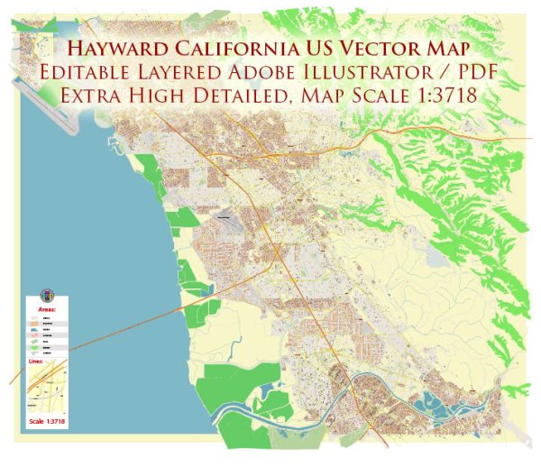
Hayward, California, is a city located in Alameda County in the San Francisco Bay Area. The city has a network of streets and roads that facilitate transportation and connect various neighborhoods. A general overview of some principal streets and roads in Hayward:
- Mission Boulevard (State Route 238): Mission Boulevard is a major north-south thoroughfare running through Hayward. It connects the northern and southern parts of the city and provides access to various businesses, residential areas, and shopping centers.
- A Street: A Street is one of the main east-west streets in downtown Hayward. It is home to the City Hall, the Hayward Public Library, and several shops and restaurants.
- Foothill Boulevard (State Route 238): Foothill Boulevard is another significant roadway in Hayward. It intersects with Mission Boulevard and runs parallel to it, serving as an alternative route.
- Jackson Street: Jackson Street is a major east-west street that intersects with Mission Boulevard and runs through the heart of Hayward. It hosts a mix of commercial and residential properties.
- Hesperian Boulevard: Hesperian Boulevard is a major north-south road in Hayward, connecting various neighborhoods and commercial areas. It is also part of State Route 185.
- Industrial Parkway: Industrial Parkway is an important road, especially in the industrial areas of Hayward. It provides access to many businesses and industrial facilities.
- Whipple Road: Whipple Road runs east-west and is an essential route in the northern part of Hayward. It connects to Interstate 880, providing access to the broader Bay Area.
- Tennyson Road: Tennyson Road is an east-west thoroughfare that connects the western and eastern parts of Hayward. It is home to a mix of residential and commercial developments.
- Harder Road: Harder Road is another east-west road in Hayward, running parallel to Tennyson Road. It passes through residential neighborhoods and has various local businesses along its route.
- Carlos Bee Boulevard: Carlos Bee Boulevard is associated with California State University, East Bay. It provides access to the university campus and is an important route for students and faculty.
For the most current and detailed information, it’s recommended to consult local maps, navigation tools, or the city’s official transportation resources.


 Author: Kirill Shrayber, Ph.D.