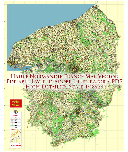
Haute-Normandie was an administrative region in northern France. However, it’s important to note that administrative divisions in France have undergone changes, and as of 2016, Haute-Normandie was merged with Basse-Normandie to form the new administrative region of Normandy. The information provided here is based on the situation before the merger.
- Principal Waterways:
- Seine River: The Seine River is a major waterway in Haute-Normandie. It flows through the region, passing through cities like Rouen. The Seine is an important navigable river, supporting commercial and industrial activities. Rouen, one of the major cities in Haute-Normandie, is known for its port facilities along the Seine.
- Railroads:
- Rail Network: Haute-Normandie had a well-developed railway network. The region was connected to the broader French railway system, facilitating the transportation of goods and passengers. The railway infrastructure played a crucial role in connecting cities and supporting economic activities.
- Rouen:
- Rouen Port: Rouen, the capital of Haute-Normandie, is situated on the Seine River and has historically been an important port city. The port facilities in Rouen are essential for trade and transportation, and they contribute significantly to the regional economy.
- Industrial Centers:
- Petroleum Industry: The region had a notable presence in the petroleum industry, with refineries located along the Seine. The Port of Le Havre, in the Lower Normandy part, is one of the largest oil and container ports in France.
- Transportation Hubs:
- Le Havre: Le Havre, a major city and port in the region, serves as a transportation hub with its maritime and rail connections. It has been a key gateway for international trade.
It’s advisable to check more recent sources for the latest information on the infrastructure and transportation networks in the Normandy region, which now includes the former Haute-Normandie.


 Author: Kirill Shrayber, Ph.D. FRGS