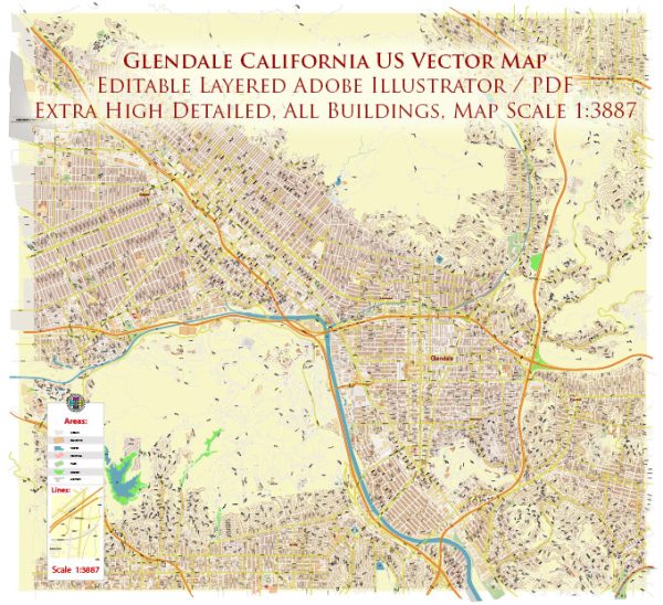
A general overview of transportation in Glendale, California.
1. Roads and Highways: Glendale is well-connected by a network of roads and highways. The city is served by major roadways, including the Ventura Freeway (SR 134), the Glendale Freeway (SR 2), and the Golden State Freeway (I-5), facilitating convenient travel both within the city and to neighboring areas.
2. Public Transportation:
- Bus Services: The Glendale Beeline provides local bus services within the city. Additionally, the Los Angeles County Metropolitan Transportation Authority (Metro) operates several bus routes that serve Glendale, connecting it to other parts of Los Angeles County.
- Metro Rail: Glendale is not directly served by metro rail, but neighboring areas have access to Metro Rail lines, making it possible for Glendale residents to use the rail system for regional travel.
3. Airports:
- Bob Hope Airport (Burbank): While not located within Glendale city limits, Bob Hope Airport (officially Hollywood Burbank Airport) is the closest major airport. It provides domestic flights and is easily accessible for residents of Glendale.
4. Bicycling and Pedestrian Infrastructure:
- Glendale has been working on improving its infrastructure for pedestrians and cyclists, with efforts to create more walkable and bike-friendly areas. This includes the development of bike lanes, sidewalks, and pedestrian-friendly zones.
5. Carpooling and Ridesharing:
- Services like Uber and Lyft are available in Glendale, providing residents with additional transportation options.
6. Future Developments:
- As of my last update, there may have been ongoing or planned transportation projects aimed at enhancing connectivity and addressing traffic concerns. It’s advisable to check with local authorities or transportation departments for the latest developments.
For the most current and detailed information about Glendale’s transportation system, you may want to consult local transportation authorities, city planning departments, or official city websites. Additionally, local news sources can provide updates on any recent changes or developments in Glendale’s transportation infrastructure.


 Author: Kirill Shrayber, Ph.D.