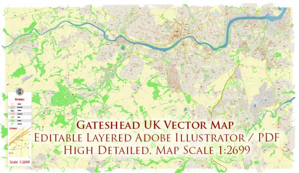
Gateshead is a town in Tyne and Wear, England, located on the southern bank of the River Tyne opposite Newcastle upon Tyne. The town has several principal streets and roads that contribute to its transportation infrastructure. Here are some key streets and roads in Gateshead:
- High Street: As in many towns and cities, High Street is often a central thoroughfare. In Gateshead, High Street is likely to have a mix of shops, restaurants, and businesses.
- West Street: Another important street in Gateshead, West Street may host various amenities and commercial establishments.
- Prince Consort Road: This road runs along the River Tyne and offers scenic views. It might be an important route for both commuters and tourists.
- Askew Road: Connecting various parts of Gateshead, Askew Road is likely to be a significant route for local transportation.
- A184 (Felling Bypass): This major road provides a crucial link between Gateshead and other areas, such as Felling and the A1 motorway.
- A167 (Durham Road): Running through Gateshead, Durham Road is an important route that connects Newcastle upon Tyne with areas south of the River Tyne.
- A185 (Sunderland Road): This road connects Gateshead with Sunderland and may be a key route for regional transportation.
- Teams Millennium Bridge: This iconic bridge connects Gateshead with the Teams area and spans the River Tyne.
- Bensham Road: Serving the Bensham neighborhood, this road is likely to have a mix of residential and commercial properties.
- Old Durham Road: Running through the heart of Gateshead, Old Durham Road is an important route that may feature a variety of businesses and services.
- Heworth Road: Connecting the Heworth area, this road is likely to be a significant local route.
Remember, urban landscapes can change, and new developments or changes to road infrastructure may have occurred since my last update. For the most current and detailed information, it’s recommended to consult local maps, navigation tools, or the official website of the local government.


 Author: Kirill Shrayber, Ph.D. FRGS