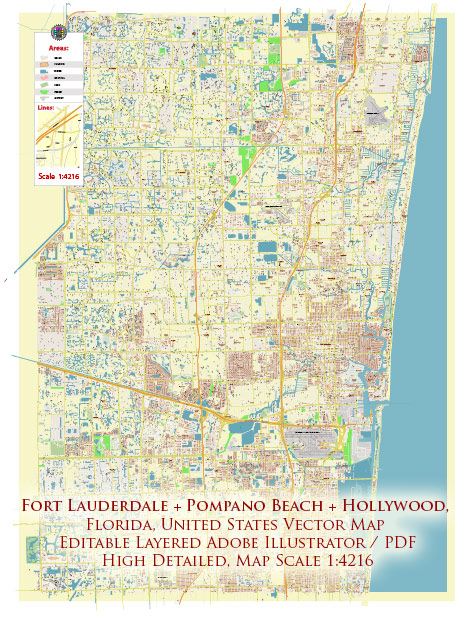
Sure, let me provide you with a brief overview of some principal streets and roads in Fort Lauderdale, Pompano Beach, and Hollywood, Florida.
Fort Lauderdale:
- Las Olas Boulevard:
- Known for its upscale shopping, dining, and entertainment.
- Connects downtown Fort Lauderdale to the beach.
- A1A (Ocean Drive):
- Runs along the coastline, offering scenic views of the Atlantic Ocean.
- Access to Fort Lauderdale Beach and various waterfront attractions.
- Sunrise Boulevard:
- Major east-west road connecting downtown Fort Lauderdale to the suburbs and shopping areas.
- Federal Highway (US 1):
- A significant north-south route through the city, lined with businesses and residential areas.
Pompano Beach:
- Atlantic Boulevard:
- East-west thoroughfare connecting the beach to the inland areas.
- Features shopping centers and residential neighborhoods.
- Pompano Beach Boulevard:
- Runs parallel to the beach, providing access to oceanfront parks and attractions.
- Powerline Road:
- Major north-south road in Pompano Beach, connecting various neighborhoods.
Hollywood:
- Hollywood Boulevard:
- Main east-west road, known for the historic downtown area.
- Features shops, restaurants, and the ArtsPark at Young Circle.
- Ocean Drive (A1A):
- Runs along the Atlantic Ocean, offering access to Hollywood Beach and the Broadwalk.
- Sheridan Street:
- Connects the beach area to the western parts of Hollywood.
- Access to residential neighborhoods and shopping centers.
- I-95 (Interstate 95):
- Major interstate highway running north-south, providing access to and from Hollywood.
These descriptions provide a general overview, and the road network in these cities is extensive. Keep in mind that road conditions and developments can change, so it’s a good idea to check for the latest maps or navigation tools for more detailed and up-to-date information.


 Author: Kirill Shrayber, Ph.D. FRGS