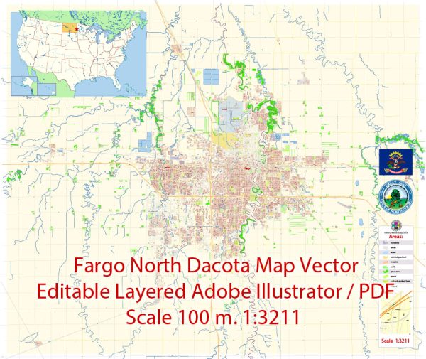
Fargo, North Dakota, is the largest city in the state and is located in the southeastern part of North Dakota, near the border with Minnesota. The city is known for its friendly community, diverse culture, and economic opportunities. Fargo has a well-planned street grid, and several principal streets and roads are vital for navigating the city. Here are some of the key streets and roads in Fargo:
- Main Avenue: Main Avenue is one of the primary east-west thoroughfares in Fargo. It runs through the heart of downtown and is home to numerous businesses, shops, and restaurants.
- 2nd Avenue North and 2nd Avenue South: These streets also run east-west and are important for navigating through downtown Fargo. They are lined with businesses, government buildings, and other services.
- Broadway: Broadway is a significant north-south street in downtown Fargo. It intersects with Main Avenue and is home to various shops, theaters, and entertainment venues.
- University Drive: Running north-south, University Drive is a major roadway that is home to many businesses, including shopping centers, restaurants, and hotels. It is also a key route for accessing North Dakota State University (NDSU).
- 13th Avenue South: This east-west thoroughfare is a major commercial corridor in Fargo, hosting a variety of retail stores, restaurants, and businesses.
- 25th Street South: Running north-south, 25th Street South is another important road, providing access to shopping centers, residential neighborhoods, and various amenities.
- I-29 and I-94: Fargo is served by two major interstates. Interstate 29 runs north-south, connecting Fargo to cities like Grand Forks and Sioux Falls. Interstate 94 runs east-west, connecting Fargo to Bismarck, the capital of North Dakota, and to Minneapolis, Minnesota.
- Veterans Boulevard: This newer road runs diagonally in the southwestern part of the city, connecting I-94 and I-29. It has become a significant commercial and residential corridor.
- 32nd Avenue South: Another major east-west road, 32nd Avenue South, is known for its shopping centers, restaurants, and other commercial developments.
- 45th Street South: Running north-south on the western side of the city, 45th Street South is a key route for accessing residential neighborhoods and businesses.
Fargo’s street grid is generally easy to navigate, with numbered streets running north-south and named avenues running east-west. The city’s infrastructure is continually evolving, so it’s advisable to consult a current map or navigation system for the latest information on streets and roads in Fargo.


 Author: Kirill Shrayber, Ph.D.