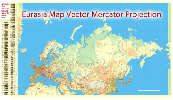
Europe and Asia, as these regions are connected primarily by several major shipping routes and canals. Some key maritime routes and canals that facilitate shipping between Europe and Asia:
- Suez Canal:
- Location: Egypt
- Description: The Suez Canal connects the Mediterranean Sea to the Red Sea, providing a crucial shortcut for ships traveling between Europe and Asia. It significantly reduces the travel distance around the southern tip of Africa.
- Bosphorus Strait:
- Location: Turkey
- Description: The Bosphorus Strait connects the Black Sea to the Sea of Marmara and, ultimately, the Mediterranean. It is an important passage for ships traveling to and from the Black Sea region.
- Strait of Gibraltar:
- Location: Spain and Morocco
- Description: The Strait of Gibraltar connects the Mediterranean Sea to the Atlantic Ocean. While it is not directly on the route between Europe and Asia, it is a significant passage for ships traveling to and from the Mediterranean.
- Malacca Strait:
- Location: Malaysia and Indonesia
- Description: The Malacca Strait is a narrow passage between the Malay Peninsula and the Indonesian island of Sumatra. It is a vital route for ships traveling between the Indian Ocean and the South China Sea.
- Bab el Mandeb:
- Location: Yemen and Djibouti
- Description: Bab el Mandeb is a strait connecting the Red Sea to the Gulf of Aden. It is an important passage for ships transiting between the Mediterranean Sea and the Indian Ocean.
- Northern Sea Route (NSR):
- Location: Arctic region, northern Russia
- Description: With the melting of Arctic ice, the Northern Sea Route has gained importance as a potential shipping route connecting Europe to Asia via the Arctic Ocean. However, ice conditions and environmental concerns make this route challenging.
- Southeast Asian Shipping Lanes:
- Description: Various shipping lanes run through the South China Sea, connecting East Asia to Southeast Asia and beyond. These lanes are essential for maritime trade between Asian countries and those in Europe and the Americas.
Shipping companies use these routes and passages to transport goods between Europe and Asia, contributing significantly to global trade. Keep in mind that developments in global geopolitics, climate change, and technology can impact the dynamics of these shipping routes. For the most up-to-date information, it’s recommended to refer to maritime authorities and shipping agencies.


 Author: Kirill Shrayber, Ph.D. FRGS