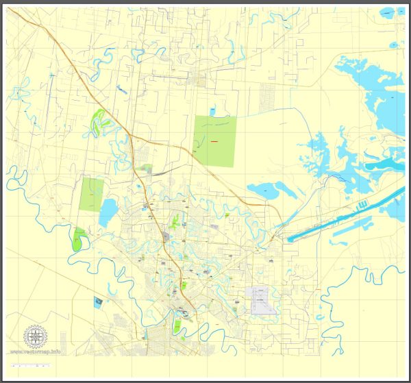
General description of Brownsville, Texas.
Brownsville is a city located in the southernmost part of Texas, in the United States. It is situated on the Gulf of Mexico, along the Texas-Mexico border. Here are some aspects of urban amenities in Brownsville:
- Cultural and Historical Attractions:
- Gladys Porter Zoo: A popular zoo with a diverse range of animal exhibits.
- Brownsville Museum of Fine Arts: Showcasing local and regional art.
- Historic Downtown District: Featuring historic architecture, shops, and restaurants.
- Recreation and Outdoor Activities:
- Boca Chica State Park: A coastal state park offering opportunities for beach activities.
- Resaca de la Palma State Park: Known for its nature trails and birdwatching.
- Education:
- University of Texas Rio Grande Valley (UTRGV) – Brownsville Campus: Provides higher education opportunities.
- Texas Southmost College: Another institution contributing to the local education landscape.
- Healthcare:
- Valley Regional Medical Center: A major hospital serving the community.
- Shopping and Dining:
- Sunrise Mall: A shopping destination with various retail stores.
- Local Restaurants and Cuisine: Brownsville offers a variety of dining options, including Mexican and Tex-Mex cuisine.
- Community Events:
- Charro Days: A traditional cultural festival celebrating the region’s Mexican and American heritage.
- Cameron County Fair and Livestock Show: An annual event featuring livestock exhibits, carnival rides, and entertainment.
- Transportation:
- Brownsville/South Padre Island International Airport: Provides air travel options.
- Public Transportation: The city has bus services for local transportation.
- Sports and Recreation:
- Brownsville Sports Park: Facilities for various sports and recreational activities.
Remember that the information provided here is a general overview, and you may want to check more recent sources for the latest developments and changes in the city.


 Author: Kirill Shrayber, Ph.D. FRGS