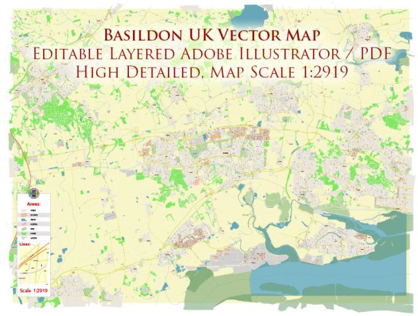
Basildon is a town in Essex, England, located about 32 miles east of Central London. The town has undergone significant development since its designation as a new town in 1949. General overview of the urban amenities in Basildon:
- Shopping: Basildon offers a range of shopping facilities, including Eastgate Shopping Centre, which houses a variety of retail outlets, restaurants, and cafes. There are also other shopping areas and markets throughout the town.
- Leisure and Recreation: Basildon has several parks and green spaces, providing opportunities for outdoor activities and relaxation. One notable park is the Wat Tyler Country Park, which offers nature trails and wildlife viewing.
- Cultural and Entertainment Venues: The town has cultural and entertainment venues, such as the Towngate Theatre, which hosts a variety of performances, including plays, concerts, and comedy shows.
- Sports Facilities: Basildon Sporting Village is a modern sports facility that includes a swimming pool, gym, and various sports courts and fields. It provides opportunities for both competitive and recreational sports.
- Education: Basildon has a number of primary and secondary schools, as well as further education institutions. This includes the South Essex College, which offers a range of courses.
- Transportation: Basildon is well-connected by road and rail. The town has its railway station, providing direct train services to London and other nearby towns. The road network includes the A13 and A127, facilitating easy access to London and other parts of Essex.
- Healthcare: Basildon has healthcare facilities, including Basildon University Hospital, which serves the local community with a range of medical services.
- Housing: The town has a mix of housing, including residential areas and apartment complexes. The housing market may offer various options for both homeowners and renters.
- Community Services: Basildon provides various community services, including libraries, community centers, and other facilities for residents to engage in social and recreational activities.


 Author: Kirill Shrayber, Ph.D. FRGS