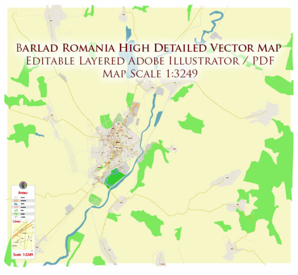
Barlad is a city located in the Vaslui County of eastern Romania. Here is a detailed geographical description of Barlad:
Location: Barlad is situated in the historical region of Moldavia, in the eastern part of Romania. It lies on the Barlad River, a tributary of the Siret River. The city is positioned at approximately 46.23 degrees latitude and 27.67 degrees longitude.
Topography: The topography of Barlad and its surrounding areas is characterized by relatively flat terrain. The landscape is part of the Moldavian Plateau, a region with gentle hills and plains. The Barlad River, flowing through the city, contributes to the overall flatness of the area.
Climate: Barlad experiences a temperate-continental climate. Winters are generally cold, with temperatures often dropping below freezing, while summers are warm with occasional hot spells. Precipitation is evenly distributed throughout the year, with a slightly drier period during the summer months.
Vegetation: The natural vegetation in the region around Barlad consists mainly of deciduous forests, agricultural fields, and meadows. The flora reflects the temperate climate, with a variety of tree species such as oak, beech, and hornbeam.
Water Bodies: The Barlad River is a significant watercourse that runs through the city. It not only contributes to the landscape but also serves as a water source for the local population. Additionally, there might be smaller streams and ponds in the surrounding countryside.
Urban Layout: The city of Barlad has a mix of historic and modern urban infrastructure. The city center may feature older architecture, including churches, squares, and public buildings, while the outskirts may have more contemporary developments. Streets are organized in a grid pattern in some areas, while others may follow a more organic layout.
Cultural and Historical Features: Barlad has a rich cultural and historical heritage. There may be notable landmarks, museums, and monuments that reflect the city’s past. The architecture might showcase a blend of styles, influenced by various periods of history.
Surrounding Areas: The countryside surrounding Barlad is likely characterized by agricultural activities, including the cultivation of crops and pastures for livestock. Villages and smaller settlements may dot the landscape, contributing to the overall rural atmosphere.
Overall, Barlad is a city situated in a region with a diverse and picturesque landscape, offering a mix of urban and rural elements.


 Author: Kirill Shrayber, Ph.D. FRGS