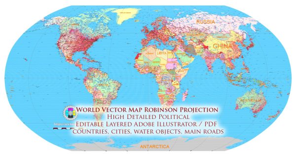
The Robinson projection is a map projection that was developed by Arthur H. Robinson in 1963. It is a compromise projection, attempting to balance several distortions in order to create a visually appealing world map. While it is a popular choice for world maps, it is not without its problems and distortions. Here are some of the key issues associated with the Robinson projection:
- Size Distortion: Like many other projections, the Robinson projection distorts the size of land masses, particularly towards the polar regions. Areas near the poles appear much larger than they actually are, while those near the equator appear smaller.
- Shape Distortion: The Robinson projection also distorts shapes, especially for land masses located far from the equator. This distortion becomes more pronounced as you move towards the poles, leading to inaccurate representations of the shapes of continents and countries.
- Direction Distortion: Direction is not consistent on a Robinson projection. While it tries to maintain reasonable directional accuracy across the map, there are still distortions, and true compass directions are not preserved.
- Polar Regions Distortion: The polar regions are highly stretched and distorted in the Robinson projection. This can make it challenging to accurately represent features near the poles.
- Oval Shape: The overall shape of the map is an elongated oval, which may not match the expectations of those accustomed to more traditional map shapes.
Despite these distortions, the Robinson projection remains popular because it provides a visually pleasing representation of the world that strikes a balance between various types of distortion. It is often used in educational settings and world maps where an aesthetically pleasing appearance is valued over strict accuracy in terms of size, shape, and distance. It’s important for map users to be aware of these distortions and choose a projection that best suits their specific needs and preferences. Different map projections are designed to minimize different types of distortion, and the choice of projection depends on the purpose of the map and the area it covers.


 Author: Kirill Shrayber, Ph.D. FRGS