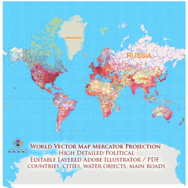
The Mercator projection, while widely used for nautical navigation and in many online mapping services, has notable distortions that can be problematic for certain applications. Here are some of the main problems and distortions associated with the Mercator projection:
- Size Distortion: Perhaps the most well-known issue with the Mercator projection is the significant distortion of size, especially as you move toward the poles. Areas near the equator are represented fairly accurately, but as you move toward higher latitudes, features become increasingly exaggerated in size. For example, Greenland appears much larger on a Mercator map than it actually is.
- Shape Distortion: While angles are preserved along lines of latitude and longitude, shapes are distorted as you move away from the equator. This is particularly noticeable in regions like Africa and South America, where features appear stretched vertically.
- Pole Distortion: The Mercator projection is infinite in extent both north and south. As a result, the representation of the polar regions is highly distorted and can be misleading. The poles are stretched into long lines, creating an unrealistic and exaggerated view of these areas.
- Direction Distortion: While angles are preserved, direction distortion occurs as you move away from the equator. Courses of constant compass direction on the map become curved lines in reality, which can be misleading for navigation.
- Inappropriate for Thematic Maps: Mercator is not ideal for thematic maps that require equal area representation, as it significantly distorts the relative sizes of land masses.
- Poor for Navigation in High Latitudes: Mercator is not suitable for navigation in high latitudes due to the extreme distortion near the poles. Sailors and pilots using Mercator charts need to be aware of the distortion in distances and directions.
Despite these distortions, the Mercator projection is still widely used for specific applications where maintaining straight lines of constant compass bearing (rhumb lines) is important, such as in sea navigation. However, for general-purpose world maps or maps emphasizing size accuracy, other projections that minimize distortion in different ways may be more appropriate.


 Author: Kirill Shrayber, Ph.D.