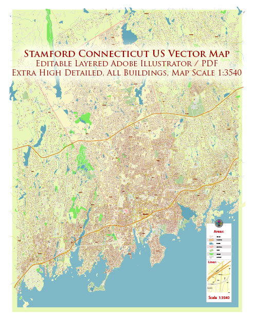
Stamford, Connecticut, has a rich history of urban development that spans several centuries. Here is a brief overview of key points in the city’s urban development:
- Early Settlement and Colonial Period (17th Century):
- Stamford was originally settled by European colonists in the mid-17th century, with the first documented European settlers arriving in 1640.
- The area was attractive for its fertile land, access to waterways, and proximity to important trade routes.
- Agricultural and Industrial Growth (18th and 19th Centuries):
- Stamford’s economy during the 18th and 19th centuries was primarily based on agriculture and local industry.
- The opening of the Erie Canal in 1825 and the arrival of the railroad in the mid-19th century facilitated transportation and contributed to the city’s growth.
- Urbanization and Expansion (Late 19th to Early 20th Centuries):
- Stamford experienced significant urbanization and population growth during the late 19th and early 20th centuries.
- The industrial revolution brought about economic diversification, and Stamford became a center for manufacturing and finance.
- Post-World War II Suburbanization (Mid-20th Century):
- Like many other American cities, Stamford witnessed suburbanization in the post-World War II era. This was characterized by the growth of suburbs, the development of highways, and an increase in automobile usage.
- The city’s population continued to grow, and there was a shift towards residential and commercial development in the suburbs.
- Urban Renewal and Redevelopment (1960s-1980s):
- Stamford, like many urban areas, underwent urban renewal projects in the mid-20th century. This involved the redevelopment of certain neighborhoods, infrastructure improvements, and the construction of modern buildings.
- Landmarks such as the Stamford Town Center, a large shopping mall, were developed during this period.
- Economic Transformation and Financial Hub (Late 20th Century to Present):
- Stamford has transformed into a major financial hub, with the presence of many corporate headquarters and financial institutions.
- The city has attracted businesses from various industries, including finance, technology, and healthcare.
- Mixed-Use Development and Modernization (21st Century):
- In recent years, Stamford has focused on mixed-use development, combining residential, commercial, and recreational spaces.
- The Harbor Point development is an example of a large-scale, mixed-use project that has contributed to the city’s modernization.
- Transportation Infrastructure:
- Stamford is a major transportation hub, with a busy Metro-North Railroad station providing commuter rail service to New York City.
- Interstate 95 runs through Stamford, connecting the city to other major urban centers in the region.
Throughout its history, Stamford has adapted to changing economic and social trends, evolving from a colonial settlement to a diverse and vibrant urban center. The city continues to play a significant role in the economic and cultural life of Connecticut and the broader New York metropolitan area.


 Author: Kirill Shrayber, Ph.D. FRGS