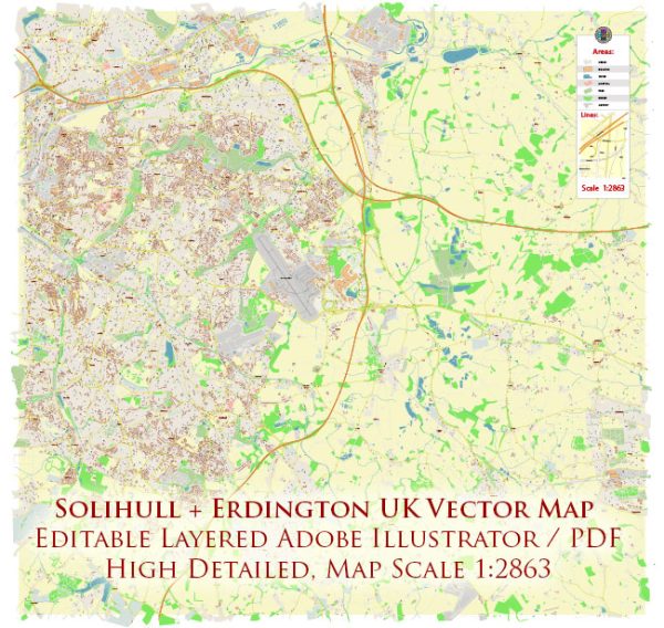
Solihull and Erdington are two distinct areas in the West Midlands, United Kingdom, each with its own unique history of urban development.
Solihull: Solihull is a town located in the Metropolitan Borough of Solihull, just southeast of Birmingham. The history of Solihull dates back to medieval times, and it was originally a market town. Over the centuries, it evolved into a prosperous area with a mix of agriculture, industry, and commerce.
- Medieval Origins: Solihull’s medieval church, St. Alphege, is a prominent landmark that reflects the town’s ancient roots. The town developed around the church and market.
- Market Town: Solihull thrived as a market town, benefiting from its strategic location on the road between Birmingham and Warwick. The market became a focal point for trade and social activity.
- Industrial Revolution: The nearby growth of Birmingham during the Industrial Revolution had an impact on Solihull. While Birmingham became an industrial powerhouse, Solihull retained its more rural character.
- 20th Century Development: In the 20th century, Solihull experienced significant suburban development, with the expansion of housing, retail, and infrastructure. The town became a desirable residential area, known for its green spaces and quality of life.
- Modern Era: Today, Solihull is a thriving town with a mix of residential, commercial, and retail areas. The Touchwood shopping center, for example, is a modern development that has added to the town’s appeal.
Erdington: Erdington is a suburb and ward of Birmingham, located to the northeast of the city center. Like Solihull, Erdington has a rich history shaped by its geographic location and economic activities.
- Early History: Erdington’s history can be traced back to the Domesday Book of 1086, which mentions a small farming community in the area. The name “Erdington” is believed to derive from the Old English words for “eagle” and “farm.”
- Industrialization: Erdington experienced significant growth during the Industrial Revolution, particularly with the development of industries such as manufacturing and metalworking. The proximity to Birmingham’s industrial heartland contributed to its economic expansion.
- Transportation Hub: The opening of the railway in the 19th century further connected Erdington to Birmingham and other nearby areas. This transportation link played a crucial role in the suburb’s development.
- Post-War Period: Like many parts of Birmingham, Erdington faced challenges in the post-war period, including industrial decline and changes in the economic landscape. However, efforts were made to regenerate and adapt to new economic realities.
- Modern Development: In recent decades, Erdington has seen ongoing urban development, with a mix of housing, commercial spaces, and community amenities. The suburb continues to be a diverse and dynamic part of Birmingham.
Both Solihull and Erdington showcase the evolution of urban areas in the West Midlands, reflecting changes in industry, transportation, and societal needs over the centuries.


 Author: Kirill Shrayber, Ph.D. FRGS