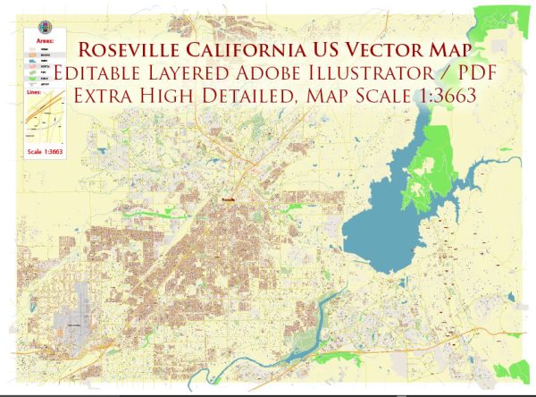
Roseville, California, has a rich history of urban development that reflects the broader trends and challenges faced by many American cities. While the following overview provides a general understanding of Roseville’s urban development, it’s essential to consult local historical sources for more detailed and up-to-date information.
- Early Settlement and Growth (19th Century):
- Roseville’s history dates back to the 19th century when it was originally a stagecoach station called “Griders” during the California Gold Rush.
- The arrival of the Central Pacific Railroad in 1864 played a pivotal role in the city’s development. The railroad selected the area as a junction point and named it “Junction” after its position as the junction of the Sacramento and Placer County lines.
- Railroad Influence and Economy:
- The railroad industry significantly influenced Roseville’s growth. In 1906, the Southern Pacific Railroad constructed a large rail yard, known as the Roseville Yard, making the city a vital transportation hub.
- The rail yard brought economic prosperity to the region, attracting businesses and residents.
- Expansion and Diversification (20th Century):
- The city continued to grow throughout the 20th century, with a particular boom in population and economic activity after World War II.
- Diversification of the economy occurred as Roseville evolved from a primarily railroad-dependent community to a more varied economic base, including retail, manufacturing, and services.
- Suburbanization and Residential Development:
- Like many American cities, Roseville experienced suburbanization trends in the mid-20th century. The availability of automobiles and improved transportation infrastructure led to the development of suburban neighborhoods.
- Housing developments, shopping centers, and schools emerged to accommodate the growing population.
- Retail and Commercial Centers:
- Roseville’s urban development includes the establishment of major retail centers, such as the Westfield Galleria at Roseville, one of the largest shopping malls in the region.
- The city’s commercial areas have continued to evolve, with a mix of retail, dining, and entertainment options.
- Modern Challenges and Planning:
- In recent years, Roseville, like many other cities, has faced challenges related to urban planning, transportation, and sustainability.
- The city has likely implemented various urban planning initiatives to address issues such as traffic congestion, infrastructure development, and environmental sustainability.
- Cultural and Community Development:
- Roseville has likely invested in cultural and community development, fostering a sense of identity and community pride.
- Parks, cultural events, and community organizations contribute to the city’s quality of life and overall urban experience.
It’s important to note that urban development is an ongoing process, and Roseville’s history and future are shaped by a variety of factors, including economic changes, demographic shifts, and local governance. For the most current and detailed information, consider consulting local historical archives, city planning documents, and community resources.


 Author: Kirill Shrayber, Ph.D. FRGS