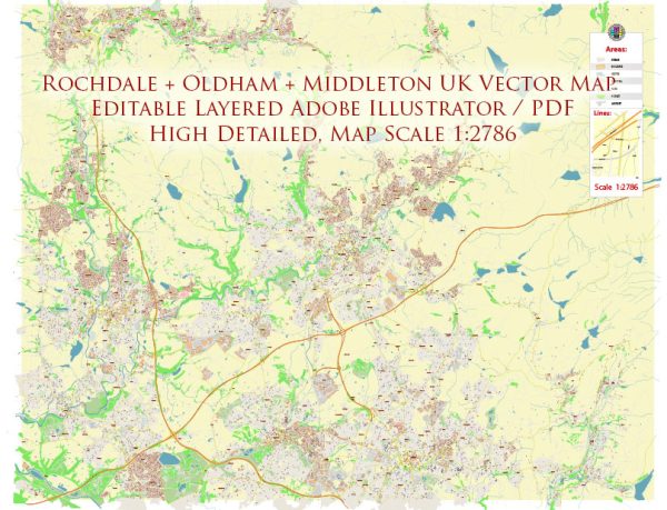
The Rochdale, Oldham, and Middleton area in the United Kingdom has a rich history of urban development that reflects the broader industrial and social changes that occurred during the 19th and 20th centuries.
- Industrial Revolution: The late 18th and early 19th centuries marked the onset of the Industrial Revolution, a period of significant economic and social transformation. The textile industry played a crucial role in this region, with cotton mills and factories becoming prominent features of the landscape. The construction of mills and associated infrastructure led to the rapid urbanization of these areas.
- Cotton Industry: Rochdale, Oldham, and Middleton were key players in the cotton industry during the 19th century. Cotton spinning and weaving mills dotted the landscape, and the region became known for its textile production. The demand for labor in these mills attracted a growing population to the urban centers.
- Transportation: The development of transportation infrastructure, including canals and later railways, further facilitated industrial growth. These modes of transport helped in the efficient movement of raw materials to the mills and the transportation of finished goods to markets, contributing to the economic prosperity of the region.
- Housing and Urban Layout: The rapid influx of workers led to the construction of worker housing, often in the form of terraced houses, to accommodate the growing population. The urban layout was influenced by the need to provide housing in close proximity to the mills, creating a distinctive industrial landscape with densely packed residential areas surrounding the industrial core.
- Social and Economic Changes: As the textile industry expanded, so did the social and economic changes. The working conditions in the mills were often harsh, leading to the rise of labor movements and trade unions advocating for workers’ rights. The region’s history reflects the broader struggles of the working class during this period.
- Post-Industrial Era: Like many other industrial regions, the Rochdale, Oldham, and Middleton area experienced economic decline in the later half of the 20th century. Deindustrialization and the closure of many mills resulted in job losses and economic challenges. Efforts were made to diversify the local economy and regenerate urban areas.
- Regeneration and Redevelopment: In more recent times, there have been efforts to regenerate and redevelop urban spaces. Former industrial sites have been repurposed, and investment in infrastructure, education, and cultural amenities has aimed to revitalize the area and attract new businesses.
- Cultural Heritage: The area has a rich cultural heritage, with historical landmarks, museums, and cultural institutions preserving and showcasing the industrial past. Understanding and celebrating this heritage is essential for the local identity and community.
In summary, the Rochdale, Oldham, and Middleton area’s urban development history is deeply intertwined with the rise and decline of the cotton industry, the impact of the Industrial Revolution, and subsequent efforts to adapt to economic changes and revitalize urban spaces in the post-industrial era.


 Author: Kirill Shrayber, Ph.D. FRGS