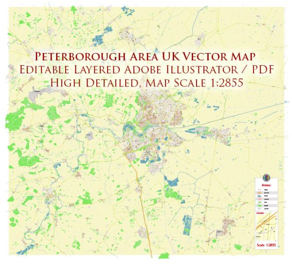
The history of urban development in the Peterborough area in the United Kingdom is a fascinating journey that spans centuries. Peterborough, located in Cambridgeshire, has a rich history shaped by factors such as its strategic location, economic activities, and societal changes. Here’s an overview of the key phases in the urban development of the Peterborough area:
- Early Settlements and Roman Influence: The area around Peterborough has evidence of early human settlements dating back to the Bronze Age. However, the city’s history became more prominent during the Roman period when the town of Durobrivae was established. This settlement was an important center for trade and commerce.
- Medieval Period: Peterborough Abbey, founded in the 7th century, played a crucial role in the region’s development. The presence of the abbey attracted pilgrims and traders, contributing to the growth of the town. The Norman Cathedral, an iconic landmark, was built during this period.
- Market Town and Economic Growth: By the medieval period, Peterborough had become a market town, and its economy thrived on trade and agriculture. The town’s strategic location on the River Nene facilitated transportation and commerce.
- Tudor and Stuart Periods: During the Tudor and Stuart periods, Peterborough continued to grow, and the cathedral underwent further expansions. The English Civil War had an impact on the area, as the town changed hands between Royalists and Parliamentarians.
- Industrial Revolution: The 18th and 19th centuries brought the Industrial Revolution to many parts of the UK, but Peterborough’s industrial growth was relatively modest compared to other regions. However, the arrival of the railway in the mid-19th century improved connectivity and stimulated economic development.
- 20th Century and Post-War Development: The 20th century saw significant changes in Peterborough. The city expanded with new residential and industrial areas. In the post-war period, there was an increased focus on housing development to accommodate a growing population.
- New Town Development: In 1968, Peterborough was designated a New Town, leading to planned expansion and the development of new housing estates. This initiative aimed to accommodate population growth and improve infrastructure.
- Recent Urban Regeneration: In more recent times, Peterborough has undergone urban regeneration projects to enhance the city’s infrastructure and public spaces. This includes the redevelopment of the city center, with improvements to shopping areas and cultural facilities.
- Economic Diversification: The economy of Peterborough has diversified over the years, with a mix of industries including manufacturing, services, and retail. The city has also seen the growth of technology and environmental sectors.
- Cultural and Educational Development: Peterborough has invested in cultural and educational facilities, including theaters, museums, and educational institutions, contributing to the overall development and vibrancy of the city.
The urban development of the Peterborough area reflects the historical and economic changes that have shaped the region over the centuries, from its early origins as a Roman settlement to its present status as a thriving city with a diverse economy.


 Author: Kirill Shrayber, Ph.D.