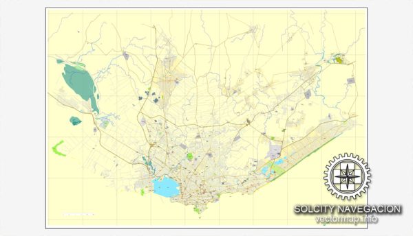
Montevideo, the capital and largest city of Uruguay, has a rich history of urban development that reflects the country’s broader socio-economic and political evolution. The city’s growth can be divided into several key phases:
- Colonial Period (1726-1828): Montevideo was founded by the Spanish in the early 18th century as a military stronghold to counter Portuguese expansion in the region. Initially, the city had a strategic role in the Spanish colonial system, and its urban layout was characterized by a fort (Ciudadela) and a compact, walled structure. The city’s growth was relatively slow during this period.
- Independence and Early 19th Century (1828-1900): Following Uruguay’s independence from Spanish rule in 1828, Montevideo began to experience increased economic activity and population growth. The city expanded beyond its original walls, and new neighborhoods emerged. The construction of the Mercado del Abasto (Abasto Market) in the 1860s marked an important development, becoming a hub of commercial activity. The city continued to grow with European immigration, particularly from Spain and Italy.
- Golden Age of Urban Expansion (1900-1950): The early 20th century witnessed a significant period of urban development in Montevideo. The cityscape underwent notable changes with the construction of iconic buildings and infrastructure projects. The Plaza Independencia, featuring the Artigas Mausoleum, was developed during this time. The expansion of the city was facilitated by the creation of new avenues, the establishment of parks, and the construction of the Rambla, a promenade along the coastline.
- Mid-20th Century to Present (1950-2022): Montevideo experienced continued urbanization and modernization during the mid-20th century. The city’s skyline evolved with the construction of high-rise buildings, and urban planning became a more prominent consideration. However, economic challenges, political instability, and social issues also influenced the city’s development during certain periods.
- Contemporary Challenges and Developments (2022 onward): In recent years, Montevideo has faced challenges such as urban sprawl, traffic congestion, and housing issues. Efforts have been made to address these challenges through sustainable urban planning initiatives, improvements in public transportation, and the revitalization of certain neighborhoods. The city continues to evolve in response to changing demographics, economic factors, and environmental considerations.
Throughout its history, Montevideo has maintained its status as a cultural and economic hub, with a unique blend of colonial and modern influences shaping its urban landscape. The city’s historic architecture, vibrant neighborhoods, and coastal features contribute to its distinct character within the broader context of South American cities.


 Author: Kirill Shrayber, Ph.D. FRGS