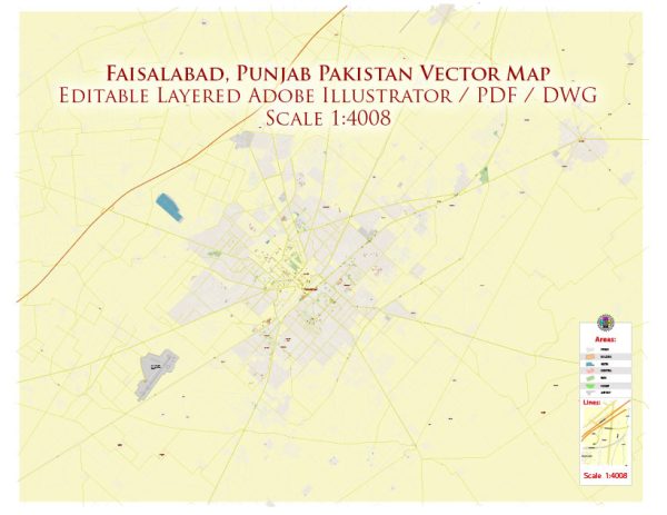
Faisalabad, formerly known as Lyallpur, is one of the major cities in the Punjab province of Pakistan. The city has a rich history of urban development that spans over a century. Here is an overview of Faisalabad’s history of urban development:
- Foundation and Early Years (19th Century):
- Faisalabad’s history begins in the late 19th century during British colonial rule. It was founded in 1880 when Sir James Lyall, the then Lieutenant Governor of the Punjab province, decided to establish a new city in the barren land of the Chenab region.
- The city was initially named Lyallpur in honor of Sir James Lyall. It served as a vital center for agriculture and trade.
- Agricultural Hub:
- Faisalabad quickly became an agricultural hub, with a focus on the cultivation of cotton and wheat. The fertile soil and the canal system provided by the British colonial administration played a crucial role in the city’s agricultural development.
- Industrialization (20th Century):
- In the early to mid-20th century, Faisalabad underwent significant industrialization. Textile and garment industries emerged as major contributors to the city’s economy.
- The British-established Lyallpur Cotton College became the University of Agriculture in 1961, emphasizing the city’s agricultural and educational importance.
- Renaming to Faisalabad:
- In 1979, the city was officially renamed Faisalabad in honor of King Faisal of Saudi Arabia, who was a friend and supporter of Pakistan.
- Population Growth and Infrastructure Development:
- Faisalabad experienced rapid population growth due to the influx of people seeking employment opportunities in the expanding industrial sector.
- Infrastructure development became a priority, with the construction of roads, bridges, and other facilities to accommodate the growing population.
- Economic Challenges and Opportunities:
- While Faisalabad thrived as an industrial and agricultural center, it also faced challenges, including environmental issues and infrastructure strain. Efforts were made to address these challenges and enhance the city’s overall livability.
- Modernization and Globalization:
- In recent decades, Faisalabad has continued to modernize and adapt to the changing global economic landscape. The city has embraced technological advancements and sought to diversify its economy beyond traditional industries.
- Education and Culture:
- Faisalabad has also developed as a center for education and culture, with numerous educational institutions and cultural events contributing to the intellectual and social vibrancy of the city.
- Challenges and Future Prospects:
- Like many other rapidly growing cities, Faisalabad faces challenges related to infrastructure, environmental sustainability, and urban planning. Future development efforts aim to address these issues while fostering economic growth and improving the quality of life for residents.
Overall, Faisalabad’s history of urban development reflects its evolution from an agricultural and trading center to a bustling industrial city with a growing emphasis on education, technology, and modernization.


 Author: Kirill Shrayber, Ph.D. FRGS