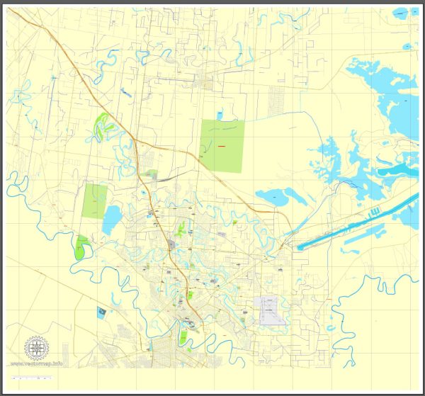
Brownsville, Texas, has a rich history of urban development that reflects its unique cultural and geographical characteristics. Here’s an overview of the city’s historical urban development:
- Early Settlement and Spanish Colonial Era: Brownsville’s history begins with the arrival of Spanish settlers in the 18th century. The region was part of a Spanish land grant called “Rancho de Santa Cruz de Buena Vista.” It was primarily used for ranching and agriculture.
- Mexican Period: After Mexico gained independence from Spain in 1821, the area that would become Brownsville was incorporated into the Mexican state of Tamaulipas. During this time, the settlement was known as “Poblado de Matamoros.”
- The Texas Revolution and the Founding of Brownsville: During the Texas Revolution in the 1830s, Brownsville played a crucial role as a supply point and crossing for Texan forces. In 1846, the United States Army established Fort Texas, which later became Fort Brown. The settlement that grew around the fort was officially named Brownsville in 1848.
- American Civil War: Brownsville was the site of battles during the American Civil War and played a key role in the Union’s blockade of Confederate ports.
- The Railroad Era: The arrival of the railroad in the late 19th century boosted Brownsville’s economic development. It became a major transportation hub for goods and people traveling between the United States and Mexico.
- Trade and Immigration: Brownsville’s proximity to the Mexican border facilitated trade and cultural exchange. The city’s growth was driven by its role as a gateway between the United States and Mexico, and it became a melting pot of cultures.
- 20th Century Development: In the 20th century, Brownsville continued to expand, with the construction of infrastructure, roads, and bridges connecting it to neighboring communities and Matamoros, Mexico. The petroleum and agricultural industries also contributed to its economic development.
- Education and Cultural Institutions: Brownsville is home to the University of Texas Rio Grande Valley and several cultural institutions, including the Historic Brownsville Museum, which preserves the city’s history and heritage.
- Challenges and Growth: Brownsville has faced challenges related to poverty and infrastructure development, but the city has made efforts to address these issues. It has seen population growth and economic diversification in recent years.
- Modern Urban Development: In recent years, urban development in Brownsville has included revitalization efforts in its historic downtown area, improving parks and recreational facilities, and expanding transportation and infrastructure to accommodate the growing population.
Brownsville’s unique location on the U.S.-Mexico border has shaped its urban development, making it a crossroads of cultures and commerce. It continues to evolve while preserving its historical and cultural heritage.


 Author: Kirill Shrayber, Ph.D.