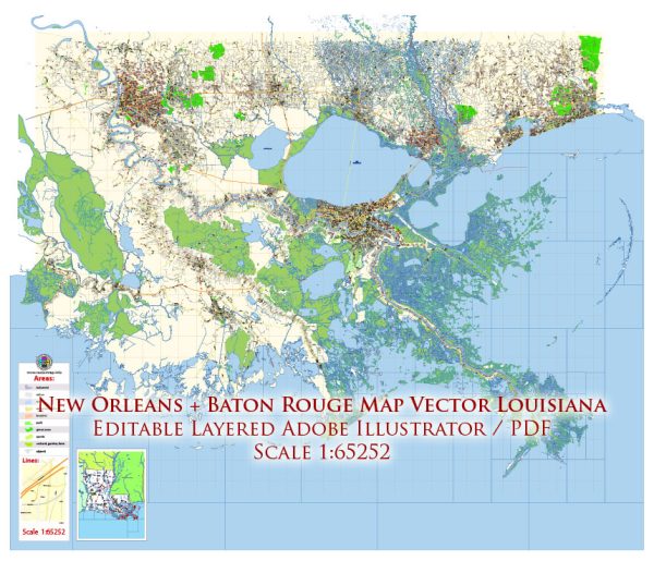
The urban development history of Baton Rouge and New Orleans, two major cities in the state of Louisiana, reflects the complex and diverse cultural and historical influences that have shaped the region. Here is a brief overview of the urban development of both cities:
New Orleans:
- French and Spanish Colonial Period (18th Century): New Orleans was founded by the French in 1718 and became part of the Spanish Empire in 1763. During this period, the city’s urban layout was influenced by European city planning, with a grid street pattern in the French Quarter.
- The Louisiana Purchase (1803): New Orleans and the entire Louisiana Territory were acquired by the United States in the Louisiana Purchase. American influence began to shape the city’s development, and the city’s population grew due to trade along the Mississippi River.
- Antebellum Era: In the 19th century, New Orleans was a major port and a center for the cotton trade. The city expanded with the development of neighborhoods like the Garden District. Plantation owners and the wealthy elite built grand mansions in these areas.
- Reconstruction and Post-Civil War: After the Civil War, New Orleans underwent urban renewal projects and expansions, which included the construction of Canal Street and various neighborhoods. The city’s famous streetcar lines also began to develop during this time.
- Industrialization and the 20th Century: New Orleans continued to grow as a port city and hub for the oil and petrochemical industries. New developments, including the construction of the Superdome, contributed to the city’s modern skyline.
- Hurricane Katrina and Post-Katrina Era: The devastating impact of Hurricane Katrina in 2005 had a significant effect on the city’s urban development. The city went through a period of recovery and rebuilding, with some neighborhoods experiencing gentrification.
Baton Rouge:
- Early Settlement and State Capital (19th Century): Baton Rouge became the capital of Louisiana in 1849. Its early development was influenced by its role as the state capital, with government buildings and institutions playing a central role in its urban layout.
- Economic Growth and Industry: Baton Rouge’s economy grew with the expansion of the petrochemical industry in the 20th century. The city became an industrial center with refineries and chemical plants, leading to suburban development and infrastructure improvements.
- Post-World War II and Urban Renewal: Like many American cities, Baton Rouge experienced urban renewal and suburbanization in the post-World War II era, with the construction of interstate highways and shopping centers. The expansion of Louisiana State University (LSU) also contributed to the city’s growth.
- Modern Development: Baton Rouge continued to experience growth and development in the late 20th century and early 21st century, with commercial and residential areas expanding, revitalization projects, and infrastructure improvements.
Both cities have unique histories and characteristics that have shaped their urban development over the years. New Orleans, with its rich cultural heritage and historical significance, has a more complex and diverse urban fabric, while Baton Rouge’s development is influenced by its role as the state capital and its industrial growth.


 Author: Kirill Shrayber, Ph.D.