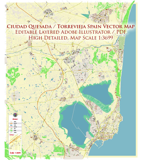
Quesada is a residential urbanization located near Torrevieja on the Costa Blanca in Spain. While it is not known for having its own specific nature parks, it is close to several beautiful natural areas and parks in the region. Here are some notable natural areas and parks near Quesada and Torrevieja:
- La Mata Natural Park: Located in Torrevieja, this park is known for its stunning saltwater lagoon, which is the largest of its kind in Europe. It’s home to a variety of bird species, making it a popular spot for birdwatching. You can enjoy scenic walks and nature trails while appreciating the unique flora and fauna of the area.
- El Hondo Natural Park: This park is situated a bit further to the north of Quesada, near Elche. It’s a wetland area with a rich ecosystem, home to numerous bird species and wildlife. It’s a fantastic place for birdwatchers and nature enthusiasts, with observation points and walking paths.
- Dunes of Guardamar: Not far from Torrevieja, this natural park features a series of beautiful sand dunes along the coastline. It’s an excellent spot for hiking and photography, and it provides a habitat for various plant and animal species.
- Sierra de Crevillent: This mountain range is located inland from Torrevieja and Quesada. It’s a lovely area for hiking and enjoying the Mediterranean landscape. The Sierra de Crevillent offers panoramic views and opportunities to explore the local flora and fauna.
- Santa Pola Salt Pans: Just a short drive from Torrevieja, the salt pans in Santa Pola are a unique natural area where salt has been traditionally harvested for centuries. It’s also a significant spot for birdwatching as various bird species can be found here.
- Las Lagunas de la Mata and Torrevieja: These two lagoons are part of the La Mata Natural Park and are known for their natural beauty. They are home to numerous bird species, and you can explore the area on walking paths and enjoy the tranquil atmosphere.
While Quesada itself may not have a designated nature park, it is conveniently located for those who appreciate the beauty of the surrounding natural areas. These nearby parks and natural spaces offer a variety of outdoor activities, including hiking, birdwatching, and enjoying the scenic landscapes of the Costa Blanca region.


 Author: Kirill Shrayber, Ph.D. FRGS