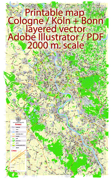
The Cologne-Bonn region in Germany is known for its diverse natural landscapes and offers a range of nature parks and outdoor recreational opportunities. While it’s not necessarily a densely forested or mountainous area, there are several parks and green spaces to enjoy. Here are a few nature parks and areas of interest in the Cologne-Bonn region:
- Königsforst: Located on the eastern outskirts of Cologne, Königsforst is a large forested area that offers extensive hiking and cycling trails. It’s a popular spot for outdoor enthusiasts and provides a peaceful retreat from the city’s hustle and bustle.
- Wahner Heide: This heathland area is situated near the Cologne-Bonn Airport and is home to a variety of plants and wildlife. It’s a unique environment for nature lovers and birdwatchers. There are walking and biking paths to explore the heath.
- Siebengebirge: A bit further south from Cologne and Bonn, the Siebengebirge is a range of seven volcanic hills, providing excellent hiking opportunities. The Drachenfels, one of the most famous hills in this range, offers stunning views of the Rhine River.
- Rodderberg: This extinct volcano is another great spot for hiking and offers panoramic views of the surrounding region, including the Rhine Valley and the city of Bonn.
- Eifel Nature Park: While not directly in Cologne or Bonn, the Eifel Nature Park is within a reasonable drive and is known for its beautiful landscapes, including lakes, forests, and volcanic craters. It’s a fantastic place for outdoor activities, including hiking and cycling.
- Bergisches Land: This hilly region, located to the east of Cologne, offers picturesque landscapes with a mix of forests, meadows, and small villages. It’s a great area for hiking and exploring the countryside.
- Rheinaue Park: Located in Bonn, the Rheinaue Park is a large urban park along the banks of the Rhine River. It’s a perfect place for leisurely walks, picnics, and outdoor events. The park also hosts various festivals and cultural events throughout the year.
These are just a few of the nature parks and outdoor destinations in the Cologne-Bonn region. Whether you’re interested in hiking, birdwatching, or simply enjoying the green spaces, you’ll find a variety of options to connect with nature and unwind in this part of Germany.


 Author: Kirill Shrayber, Ph.D. FRGS