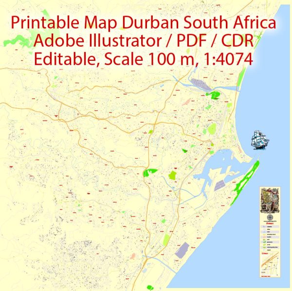
Durban is a major city located on the east coast of South Africa in the province of KwaZulu-Natal. It has a network of streets and roads that make up its urban infrastructure.
- West Street (Dr. Pixley KaSeme Street): Formerly known as West Street, this major thoroughfare was renamed Dr. Pixley KaSeme Street in honor of a prominent anti-apartheid activist. It runs through the heart of the central business district and is lined with numerous businesses, offices, and retail outlets. It’s a bustling area with a mix of historic and modern buildings.
- Florida Road: Florida Road is a popular and vibrant street in the Berea neighborhood. It’s known for its trendy restaurants, cafes, bars, and boutique shops. It’s a hub for nightlife and entertainment, making it a popular destination for both locals and tourists.
- Umhlanga Rocks Drive: Umhlanga Rocks Drive is a significant road that leads to the affluent suburb of Umhlanga and the coastal region of Umhlanga Rocks. It’s a scenic route with views of the Indian Ocean and is lined with hotels, shopping centers, and various amenities.
- Victoria Embankment (Esplanade): The Victoria Embankment, also known as the Esplanade, is a prominent road that runs along Durban’s waterfront. It offers stunning views of Durban’s harbor and is home to several iconic landmarks, including the Durban City Hall and the Royal Natal Yacht Club.
- Innes Road: Innes Road runs through the residential area of Morningside and connects with Florida Road. It’s a tree-lined street with a mix of residential homes and businesses. This road is often used as an alternative route to the city center.
- Edwin Swales Drive: Edwin Swales Drive is a major road that serves as a crucial link between various parts of Durban, including the southern suburbs and the industrial areas. It’s an important transportation route, particularly for commercial traffic.
- Durban North Beach Promenade: This isn’t exactly a street but a promenade that runs parallel to the North Beach in Durban. It’s a scenic walkway that provides access to the beach, numerous restaurants, and recreational facilities.
These are just a few examples of principal streets in Durban. The city’s road network is extensive and diverse, catering to both its urban and suburban areas. Keep in mind that road names and infrastructure may have changed since my last update, so it’s a good idea to consult a current map or local resources for the most up-to-date information.


 Author: Kirill Shrayber, Ph.D. FRGS