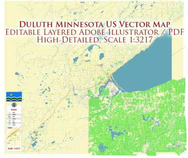
Duluth, Minnesota, located in the United States, has a well-developed transport system that caters to both residents and visitors. The city’s transportation infrastructure includes various modes of transportation, such as road networks, public transit, airports, and seaports.
- Road Transportation:
- Highways: Duluth is a major transportation hub in the region, with several important highways converging in the city. Interstate 35 connects Duluth to the Twin Cities (Minneapolis and St. Paul) to the south, while Interstate 535 and U.S. Highway 53 provide connections to Superior, Wisconsin. U.S. Highway 2 runs east-west through the city, connecting to other parts of northern Minnesota and Wisconsin.
- Local Roads: The city has an extensive network of local roads and streets, providing access to residential areas, businesses, and recreational facilities.
- Public Transit:
- Duluth Transit Authority (DTA): The DTA operates the public bus system in Duluth, providing a convenient means of transportation for residents and visitors. DTA offers regular bus services, paratransit services, and seasonal trolley services.
- Biking and Walking:
- Duluth is known for its extensive network of bike lanes and walking trails, making it a pedestrian and cyclist-friendly city. The city has implemented various initiatives to encourage active transportation and reduce traffic congestion.
- Airports:
- Duluth International Airport (DLH): Located just north of the city, Duluth International Airport serves the region with both commercial and general aviation services. Several major airlines offer daily flights to and from the airport, connecting passengers to destinations across the United States.
- Water Transportation:
- Duluth is a major port city on the western tip of Lake Superior and serves as an international seaport. The Port of Duluth-Superior is the largest and farthest-inland freshwater seaport in North America. It handles a significant amount of cargo, primarily iron ore, coal, and other bulk commodities.
- Railway:
- Duluth also has a well-developed railway network, with multiple rail lines connecting the city to destinations throughout the United States and Canada. Rail transportation plays a crucial role in the region’s economy, particularly in the transportation of bulk goods.
- Lake Superior Maritime Traffic:
- Duluth’s position on Lake Superior makes it a crucial center for maritime traffic, including cargo ships, lake freighters, and recreational boating. The Aerial Lift Bridge, a notable landmark, allows vessels to pass through the Duluth Ship Canal, connecting Lake Superior to the Duluth-Superior Harbor.
- Ridesharing and Taxis:
- Ridesharing services like Uber and Lyft are available in Duluth, providing an alternative to traditional taxis for on-demand transportation within the city.
Overall, Duluth, Minnesota, offers a comprehensive transportation system that includes roadways, public transit, air travel, and access to the Great Lakes, making it an important transportation and logistics center for the region. The city’s transportation infrastructure is essential for its economy and its role as a gateway to the western tip of Lake Superior.


 Author: Kirill Shrayber, Ph.D.