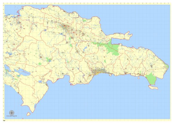
The Dominican Republic has a transportation system that includes various modes of travel, allowing residents and tourists to move around the country efficiently. Here’s an overview of the transportation options in the Dominican Republic:
- Roads and Highways:
- Highways: The Dominican Republic has a network of well-maintained highways and roads that connect major cities and tourist destinations. The primary highway is the Autopista Duarte, which runs from Santo Domingo in the south to Santiago in the north.
- Local Roads: In rural areas, local roads can vary in quality, and some may be unpaved. However, major tourist areas typically have good road infrastructure.
- Public Buses:
- Guaguas: These are shared, small buses or vans that operate on set routes within cities and towns. They are an affordable way to get around locally but may not always follow a strict schedule.
- Carros Públicos: These are similar to guaguas but are more commonly used for intercity travel. They are often color-coded according to their routes.
- Taxis:
- Taxis are readily available in most urban areas, and they can be hailed on the street or called via phone apps. It’s advisable to agree on a fare or use a metered taxi in larger cities like Santo Domingo.
- Rental Cars:
- Renting a car is a popular option for tourists who want the flexibility to explore the country at their own pace. International rental car companies operate in major cities and at airports.
- Motorcycles and Scooters:
- Motorcycles are a common mode of transportation in the Dominican Republic, especially in urban areas. Tourists can rent scooters for a fun and convenient way to explore.
- Public Transportation in Santo Domingo:
- In the capital city, Santo Domingo, there is a modern and reliable metro system with two lines that serve various parts of the city.
- Santo Domingo also has a public bus system, though it may not be as tourist-friendly as the metro.
- Air Travel:
- The Dominican Republic has several international airports, with the primary one being Las Américas International Airport (SDQ) in Santo Domingo. Other major airports include Punta Cana International Airport (PUJ) and Gregorio Luperón International Airport (POP) in Puerto Plata.
- Several smaller regional airports serve domestic routes and can be convenient for traveling between different regions of the country.
- Ferries:
- Ferries operate between the mainland and some of the country’s islands, such as Isla Saona and Isla Catalina. They are often used for day trips and transportation to these beautiful destinations.
- Cycling:
- Cycling is a growing trend in the Dominican Republic, and some areas offer bike-friendly infrastructure, especially in urban centers.
- Trains:
- While there is a limited railway network, it is not a common mode of transportation for travelers.
Overall, the Dominican Republic offers a variety of transportation options, from modern highways and public transit in major cities to more traditional modes of travel in rural areas. Depending on your destination and the purpose of your trip, you can choose the mode of transportation that best suits your needs and preferences.


 Author: Kirill Shrayber, Ph.D. FRGS