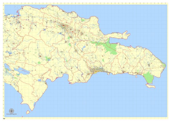
The Dominican Republic has an extensive road network that connects major cities, tourist destinations, and various regions of the country. The road infrastructure varies in quality, with some major highways and routes being well-maintained, while others may be in need of repair. Here’s a description of some of the principal roads in the Dominican Republic:
- Autopista Las Américas (Highway of the Americas):
- This is a major toll highway that connects the capital city, Santo Domingo, with the eastern region of the country.
- It is a well-maintained, modern highway that facilitates quick and efficient travel to the popular tourist destination of Punta Cana.
- Autopista Duarte (Duarte Highway):
- This highway runs from Santo Domingo to Santiago, the second-largest city in the Dominican Republic.
- It is a critical transportation route and is part of the Pan-American Highway, connecting the southern and northern coasts of the country.
- Carretera Sánchez (Sánchez Highway):
- This road links Santo Domingo to the southwest region of the country, including important cities like San Cristóbal and Bani.
- It is a vital route for both local and long-distance transportation.
- Carretera Mella (Mella Highway):
- Connecting Santo Domingo to the eastern region of the country, including the city of San Pedro de Macorís.
- It provides access to the southeastern coast, popular for its beautiful beaches.
- Autovía del Este (East Expressway):
- This is a toll road that extends from San Pedro de Macorís to La Romana and Higüey, serving as a key route for reaching the eastern tourist destinations.
- Autopista 6 de Noviembre (November 6th Highway):
- Running west from Santo Domingo, it connects the capital to the city of Azua and beyond.
- This highway provides access to the southwestern region of the country.
- Carretera Nagua – Samaná (Nagua-Samaná Highway):
- Connecting the town of Nagua to the Samaná Peninsula in the northeast, this road provides access to the popular tourist area of Samaná.
- Carretera Puerto Plata – Santiago (Puerto Plata-Santiago Highway):
- Linking the cities of Puerto Plata and Santiago, it is a crucial route for transportation in the northern region of the country.
- Carretera Romana – Higüey (La Romana-Higüey Road):
- Connecting the cities of La Romana and Higüey in the east, this road is important for access to tourist destinations like Punta Cana.
- Carretera Barahona – Pedernales (Barahona-Pedernales Road):
- Running along the southwestern coast, this road provides access to the cities of Barahona and Pedernales and their scenic surroundings.
While these are some of the principal roads in the Dominican Republic, it’s essential to note that road conditions can vary, and travelers should exercise caution, particularly on rural or less-traveled routes. Additionally, traffic and driving customs may differ from what you’re used to, so it’s important to drive safely and be aware of local regulations.


 Author: Kirill Shrayber, Ph.D.