Des Moines, Iowa: Geographic and Historical Overview
Geographic Description
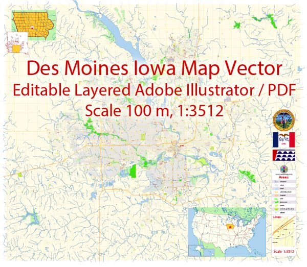
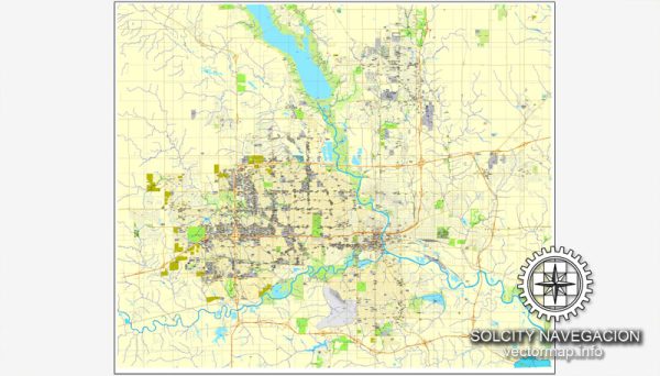
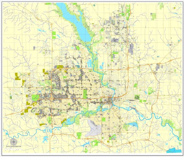
Des Moines is the capital and most populous city in the state of Iowa, located in the central United States. Situated in Polk County and extending into Warren County, Des Moines is positioned along the confluence of the Des Moines River and Raccoon River. This location has historically made it a focal point for transportation, agriculture, and trade.
Location and Layout
- Coordinates: Approximately 41.6° N, 93.6° W.
- Area: The city spans 90.65 square miles (234.8 km²), with about 89% being land and the rest water.
- Topography: The city sits on relatively flat terrain with some rolling hills. Elevations vary slightly, averaging around 955 feet (291 m) above sea level.
Des Moines is a hub for road, rail, and air transport:
- Highways: Major interstates such as I-80 (east-west corridor) and I-35 (north-south corridor) intersect here, making it a critical transportation node.
- Airport: The Des Moines International Airport (DSM) serves as a key regional hub.
Natural Features
- Rivers: The Des Moines River flows from northwest to southeast through the city, while the Raccoon River intersects from the west.
- Parks and Green Spaces: The city is home to several parks, trails, and natural reserves, such as Gray’s Lake Park and the Neal Smith Trail, which highlight the region’s prairie and wetland ecosystems.
Climate
Des Moines experiences a humid continental climate, characterized by hot, humid summers and cold, snowy winters. Precipitation is relatively evenly distributed throughout the year, supporting the region’s agricultural productivity.
Historical Overview
Des Moines has a rich history that reflects both its Native American heritage and its development as a central player in the American Midwest.
Early History
- Indigenous Roots: The Des Moines area was originally inhabited by Native American tribes, including the Ioway, Sauk, and Meskwaki peoples. The rivers were vital for sustenance, transportation, and trade.
- European Exploration: French explorers first mapped the area in the 17th and 18th centuries. The name “Des Moines” likely derives from the French term “Rivière des Moines” (River of the Monks), referencing Trappist monks thought to have lived in the area.
19th Century
- Fort Des Moines: The settlement began as a military outpost in 1843, established to protect settlers and oversee relations with Native Americans following the Treaty of 1842. The fort was abandoned in 1846.
- Statehood and Incorporation: Iowa became a state in 1846, and Des Moines was officially incorporated as a city in 1851. It became the state capital in 1857, replacing Iowa City due to its more central location.
Economic Development
- Coal Mining and Agriculture: In the late 19th and early 20th centuries, Des Moines became a center for coal mining and agriculture, with the fertile soils of the surrounding plains making it a prime area for corn and soybean production.
- Insurance Industry: By the early 20th century, Des Moines emerged as a hub for the insurance and financial services industry, earning it the nickname “Insurance Capital of the World.”
Modern Era
Today, Des Moines is a thriving urban center with a diversified economy encompassing finance, insurance, healthcare, and technology. It is also recognized for its vibrant arts and cultural scene, bolstered by attractions like the Des Moines Art Center, the Iowa State Capitol, and the Pappajohn Sculpture Park.
Des Moines frequently ranks highly in surveys of livability due to its strong job market, affordable cost of living, and emphasis on education and community development.
Des Moines, Iowa, has a well-planned street grid system that is easy to navigate. The city is divided into four quadrants: Northeast, Northwest, Southeast, and Southwest, with the State Capitol building at the center. Here are some principal streets and descriptions in each quadrant:
Northeast Quadrant:
- East Grand Avenue: This is a major thoroughfare running east to west. It connects downtown Des Moines to the eastern suburbs and is home to many businesses, restaurants, and cultural institutions.
- Euclid Avenue: Euclid Avenue runs east-west and is known for its historic homes and tree-lined streets. It’s a scenic route through residential neighborhoods.
- Hubbell Avenue: This street stretches from the city’s northeast to the southeast and is a commercial and retail corridor with various shopping options.
Northwest Quadrant:
- Ingersoll Avenue: Ingersoll is a popular street in the city, featuring a mix of historic and modern architecture, shops, restaurants, and bars. It’s known for its vibrant atmosphere.
- Beaver Avenue: Beaver Avenue is a north-south route that runs through residential neighborhoods in the northwest quadrant.
- Merle Hay Road: This major road in the northwest quadrant is home to Merle Hay Mall, one of the city’s shopping destinations.
Southeast Quadrant:
- Fleur Drive: Fleur Drive is an important arterial road that runs along the Des Moines River. It provides access to the airport and the Water Works Park, offering scenic views and recreational opportunities.
- Indianola Avenue: Indianola Avenue extends south from downtown Des Moines, passing through neighborhoods and offering access to several parks.
Southwest Quadrant:
- SW 9th Street: Running north-south, SW 9th Street is home to a variety of businesses, including restaurants, shops, and services. It’s a vital corridor in the southwest quadrant.
- Mills Civic Parkway: Located in the western part of the city, this road connects to West Des Moines and Jordan Creek Town Center, a major shopping and entertainment complex.
- Army Post Road: Army Post Road stretches across the southwest quadrant, featuring a mix of residential areas, commercial establishments, and services.
Keep in mind that Des Moines has many more streets and avenues, but these are some of the principal ones that provide access to various neighborhoods and attractions throughout the city. Des Moines’ street grid is generally easy to navigate, with numbered streets running north-south and lettered streets running east-west.


 Author: Kirill Shrayber, Ph.D. FRGS