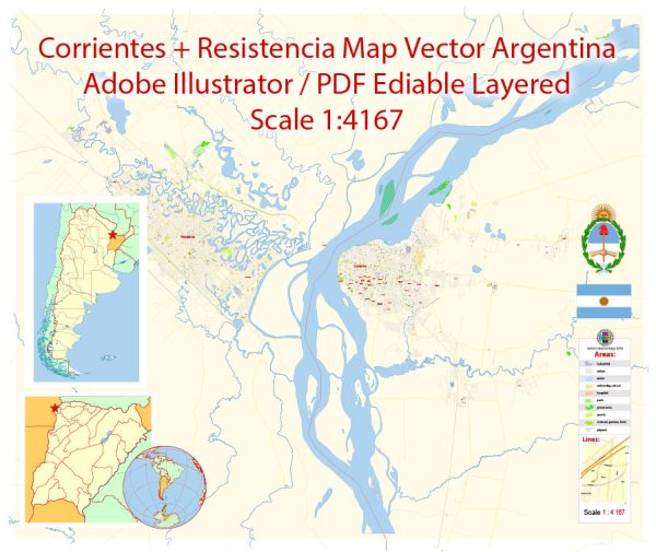
Corrientes and Resistencia are two important cities in Argentina, and they are located in the northeastern part of the country. Both cities have access to water resources, with Corrientes being situated along the Paraná River and Resistencia near the Paraguay River. These rivers play a crucial role in providing water resources, transportation, and economic opportunities for the region.
Water Resources:
- Paraná River: Corrientes is situated along the eastern bank of the Paraná River, one of South America’s major rivers. The Paraná River provides a vital water resource for the city, supporting activities like shipping, fishing, and recreational water sports.
- Paraguay River: Resistencia is located near the Paraguay River, another important watercourse in the region. Like the Paraná River, the Paraguay River offers opportunities for transportation and recreational activities.
- Local Rivers and Streams: In addition to these major rivers, both cities have access to smaller local rivers and streams that contribute to their water resources and serve various purposes, including irrigation and leisure.
Bridges:
- General Manuel Belgrano Bridge: This bridge connects the cities of Corrientes and Resistencia and spans the Paraná River. It is a significant transportation link for the region, facilitating the movement of people and goods between the two cities.
- Chaco-Corrientes Bridge: Also known as the “San Ignacio de Loyola Bridge,” it connects the city of Corrientes with the Chaco province and spans the Paraná River as well. This bridge plays a critical role in facilitating trade and travel between Corrientes and Chaco.
- Other Local Bridges: Both Corrientes and Resistencia have additional local bridges that provide transportation links within the cities and across smaller rivers and waterways. These bridges support daily commuting and the flow of goods and services.
These water resources and bridges are essential for the economic development, transportation, and daily life of the residents of Corrientes and Resistencia, as they provide access to water, facilitate trade, and connect the two cities and their surrounding areas.


 Author: Kirill Shrayber, Ph.D. FRGS